


 Caspian Sea coastal area consists of the Quaternary deposits, while its shoreline configuration varies in different places. The coasts are smooth and invariable in some places whereas in other places they are tortuous. There are such gulfs as Gizlar, Astrakhan, and Mangishlag, as well as a variety of bays. The peninsula of Agrakhan, Buzachi, Tub-Karagan, and Mangishlag is very interesting. Both Volga and Ural Rivers's mouth shorelines are variable and consist of numerous small islands and distributary channels. Caspian middle sector shoreline configuration is characterized by a smooth outline. The Absheron Peninsula is located on the western margin of the Caspian Sea, right where the middle and the southern sectors are bordering each other. To the west of the Absheron Peninsula, there are several islands and shoals of the Absheron archipelago. The largest Pirallahi and Chilov Islands. To the south of the Absheron Peninsula, there are islands of the Baku archipelago as Hara Zira, Gum, Chigil, Gil, Garasu, Zanbil, Sangi-Mughan, Dash Zira, Kur Dashy, etc. Middle Caspian east shoreline is more tortuous. The most profound feature here is Kazakh gulf with Kandarly bay, as well as Peschany, Rakushechny, and Sue spit. The biggest gulf of the sea east margin is Gara-Boghaz-Gol gulf. The origin of the listed islands and some shoals located within the Caspian south sector (Livanovo etc) is associated with the bottom-sea mud-volcanoes activity.
The Caspian Sea has about 50 small and large islands that embrace a 350sq km area. Some of them have been mentioned above. South off, at the entrance into the Hirkan gulf, there are large Ashur and several other small islands. At the beginning of the last century, these islands belonged to Tsar Russia that later on February 26, 1921, were transferred to the possession of Iran by the Soviet Government. Due to the sea-level fluctuation, Ashur-Ada Island recurrently joins to the mainland through a narrow bar and became an isolated island.
Azerbaijan coastal areas in most places consist of accumulative lowland — Samur-Davachi in the north, the southeast part of Kur-Araz Rivers lowland, and Salyan plain within its central part, as well as Lankaran lowland in the south. The shoreline between the Samur River mouth and the Absheron Peninsula is almost not tortuous. In this shoreline sector, only the Samur River delta and Gilazi cape come forward insignificantly. South off Gilazi cape shoreline gradually turns eastward and beginning from the close vicinity of Sarigayabashi spit up to Kohna Bilgah (Amburan) spit and passes into north Absheron Peninsula shoreline.
The Absheron Peninsula forms the southeast termination of the Major Caucasus and represents the largest peninsula within the west coastal area (its length exceeds 60 km, and its width is about 30 km). Its shoreline configuration is tortuous. There are accumulative bays and spits formed by solid rock cropped out to the surface (Kohna Bilgah, Shuvalan, Gurgan, etc).
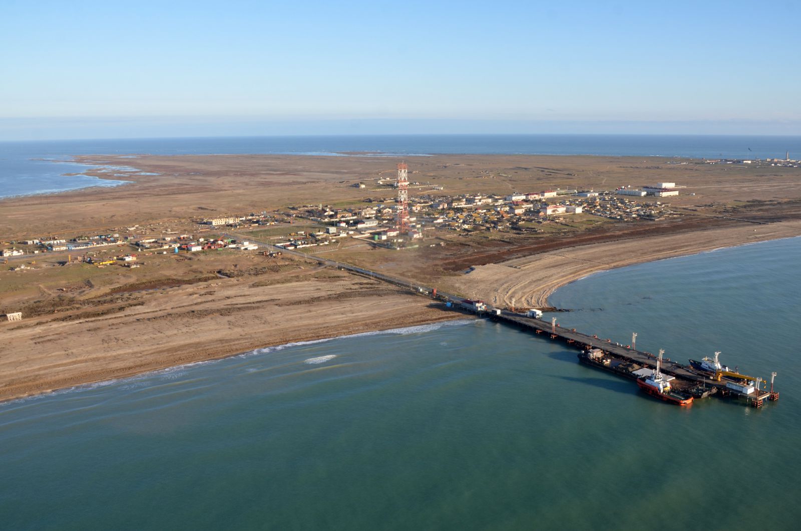
Coastal areas around the spits consist of sands that form excellent beaches. The embankment road was built up between the Absheron Peninsula and Pirallahi Island (1941) that transformed the former Absheron strait into north and south Absheron bays. 12 km long Shah spit is located on the Absheron Peninsula southeast termination.
South off the Absheron Peninsula and up to Kur River delta shoreline is tortuous. Within this shoreline section, there are Puta, Sangachal, Alat, and Pirsagat capes formed with solid rocks exposed to the surface, and in addition, there is Bandovan cape formed with mud volcanoes solid outbursts, as well as several embayments located between them. The coastal area between Shih and Alat spits consists of hills and elevations up to 400 m high. Most of them were originated due to mud-volcanoes activity.
Kur river delta is the largest one within the Caspian west coastal area. Gizilaghaj gulf and the same name sanctuary is located between Kur River delta and Sari Peninsula.