


The favorable natural and geographical conditions of Azerbaijan caused the settling of people on its territory.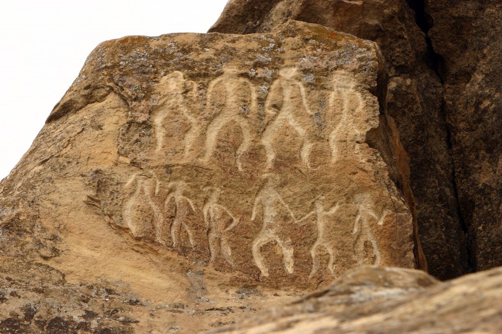
Ancient writers Herodot (5th century B.C.), Polibey (200 B.C-120 B.C), Strabon (64/63- B.C-23/24 A.M), Claudi Ptolemy (approximately 90-160) and provided coverage of geographical borders of Azerbaijan, rivers, inhabited regions, tribes, residing in the country, the Caspian Sea in a number of their creative works. Later Arabian geography scientists and travelers Ibn Khordadbeh (820/826-912/913), Abu-Ishaq Isterkhi (appr. 820-934), Azerbaijani scientist Mohamed Nakhchivani (late 13th-mid 14th centuries), Iranian scientists Reshidaddin Fazlullah (1247-1317) wrote about the economics of Azerbaijan, its administrative division, mountains, and rivers, the distances between them, trade roads, etc. Albanian (Caucasus) historian Musa Kalantarli (7-8th century) in his work "The History of Albania" described Albania as a world-famed country with rich nature and dense population, fertile soils, beautiful gardens, and green plains. The world map (1459) of Venetian F.Maurov, the maps of Alsharif (1601), German scientist and traveler A. Olear), as well as the map "East Transcaucasia and the Caspian Sea", drawn in 1720 and issues in 1723 by order of Peter the First included the inhabited regions, lakes and rivers of Azerbaijan.
Azerbaijani geographical scientist Abdurrashid Bakuvi expressed his views on the climate of Azerbaijan, the nature of Baku, and oil production in this town, Haji Zeynalabdin Shirvani, and Abbasgulu Agha Bakikhanov shared their opinions on the geographical features of our country. V. Abikh, I.Figurovsky, A.Zakharov, and others made a great contribution to the exploration of the territory of Azerbaijan as well. A complex exploration of Azerbaijan started in the period of the Soviet Union when differently scaled maps were issued and geographical atlases were drawn. The Academy of Science of Azerbaijan played an important role in a comprehensive study of the territory of our country.
The historical and geographical position of the Azerbaijan Republic
Ancient Azerbaijan situated in Central Asia and covered the area from the southeastern Caucasus to the mountain area south and south-east of Lake Urmia. Its area exceeds 200 thousand km2.
Entire Azerbaijan situates in the northern hemisphere in approximately the same latitude as Spain, Greece, Turkey, China, Korea. The strategically important roads leading from Europe to Central and Eastern Asia passed through Azerbaijan.
The territory of the republic extends 400 km from north to south, and 500 km from west to east, and locates between latitude 38'25"-41'55" North and longitude 50'-50'51" East.
The Republic situated on the junction of Europe and Asia has a unique geopolitical and geographical position and had not lost its strategic importance for economic and cultural relations.
Landscape
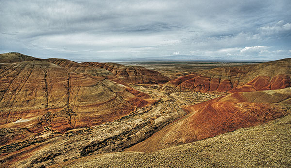
Azerbaijan is characterized by a diverse landscape. There are two major forms of landscape-plains and mountains.
Mountains cover 60% of the total area of the Azerbaijan republic. The principal geomorphological structures of the Azerbaijan Republic — Major Caucasus, Minor Caucasus (with Garabagh plateau), and Talysh mountains surround the Kur-Araz lowland in the north, west, and southeast. The Nakhichevan Autonomous Republic is situated in the mid-course of the River Araz and within the boundaries of Zengezur and Dereleyez chains of mountains, fringing with the river.
The average altitude of the territory of the Republic is up to 400 meters. But the lowland of the Caspian Sea shore is below sea level (currently -26.5 meters) while the highest peak Bazarduzu is 4466 meters in height. Thus, one can see that the difference in altitude equals nearly 4500 meters in the country.
The northern part of the Major Caucasus is situated in Azerbaijan. Two chins of mountains are distinguished in this part: Head or Watershed chain with Bazarduzu (4466 meters) and Great (Side) chain of mountains with Shahdagh alp (4243). Mountains chains go down to 1000-700 meters to the South-East. The mountain chains of Major Caucasus are surrounded by foothill areas: a steppe plateau to the north-west, Gobustan to the south-east, Alazan-Ayrichay plain to the south-west, and Gusar sloping plain to the north-east.
The mountains are formed by less exposed to denudation sinking rocks of the Cretaceous and Jurassic periods. Foothills are characterized by badlands (Jeyranchol and Ajynour plains) and mud volcanos (Gobustan and Absheron). Gusar and Alazan-Hefteran valley is composed of a thick layer of quaternary gravel sediments.
The minor Caucasus surrounds the country in the southwest and west and is composed of a number of chains and plateaus with a relatively low height. Murovdag, Shahdagh, and Zangazur are the principal chains of Minor Caucasus. Garabagh plateau, extending from the south of Murovdagh up to the river Araz, lies on the cones of extinct vulcanos and quaternary lava. The minor Caucasus is formed by Jurassic and Cretaceous volcanogenic and sedimentary rocks.
Talysh mountains cover the southeast of the country. They are composed mainly of Tertiary sediments. Talysh mountains are the chain of transition from the Minor Caucasus to the Elbrus mountains in Iran. They consist of three mountain chains, reaching 2477 meters in height and a number of their ranges.
Kur-Araz lowland lies in the area between the Major and Minor Caucasus and Talysh Mountains. As the largest intermontane lowland in the entire Transcaucasia, it covers the central part of the country. The Kur and Araz rivers divide the lowland into five plains: Shirvan, Garabagh, Mil, Mughan, and Salyan plains.
Samur-Devechi lowland, resting on Gusar sloping plain on the Caspian Sea shore, stretches from the Absheron peninsula to the north. Lankaran lowland runs from the Absheron Peninsula to the south on the foothills of Talysh mountains. Kur-Araz, Samur-Devechi, Lankaran lowlands, and most parts of the Absheron peninsula lie below sea level.
Climate
The climate in Azerbaijan is major influenced by geographical position, landscape, and the Caspian Sea. The semidesert and dry, subtropic, temperate, and frigid types of climate dominate the country. It has been determined that Azerbaijan accounts for 8 out of 11 climate zones, existing in the world (by V.V.Keppen). The dry subtropical climate is typical for Kur-Araz lowland and Absheron. The damp subtropic climate is observed only in Talysh mountains, foothills, and Lankaran lowlands. Temperate climate observed the slopes of Major and Minor Caucasus mainly covered with forests is divided into dry, warm-temperate dry, warm-temperate damp and temperate zones. The frigid climate is typical of high mountain ranges, at the tops of Major and Minor Caucasus, alpine, subalpine meadows. The average annual temperatures equal 15C on the plains while in high mountain regions they fall even below zero. Temperatures reach 25-27C in Aran regions and 5C in mountain regions in July. The absolute maximum is 43C, while the minimum is lower than -30C. These minimal and maximal temperatures have been registered in the Nakhichevan lowland and mountains. Precipitation is also not equal across the territory of the country. The Absheron peninsula and the Nakhichevan Autonomous Republic account for a lower level of precipitation per year (200 meters). Precipitations equal 200-300 mm in Kur-Araz lowland, 600-800 mm on north-eastern slopes of Major and Minor Caucasus, 1200-1300 mm on southern slopes of Major Caucasus at a height of 2000-2500 meters. Precipitation is the highest (1200-1700 mm) in the south of Lankaran lowland and the foothills of Talysh mountains.
Predominant winds blow to the north (the Absheron peninsula), south-west (Kur-Araz lowland), and west (Lankaran lowland).
Inland Water
The dense river system of the country covers its territory like a blue spider's web. Azerbaijan accounts for 8400 small and large rivers, including 850 over 5 kilometers in length. Bust there are only 24 rivers extending to over 100 kilometers.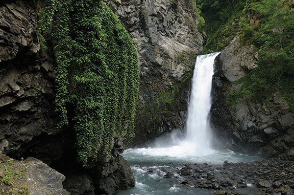
The rivers Kur and Araz-the largest rivers in the Caucasus are the main sources of hydroelectric energy and irrigation.
The river Kur originates at a height of 2740 meters on the north-eastern slope of Qyzylgedikdagh in Turkey. It passes through Georgia and enters Azerbaijan, runs through Kur-Araz lowland, and flows into the Caspian Sea. Its total length is 1515 km, with 906 kilometers in Azerbaijan. The area of its basin is 188 thousand kilometers. Mingechevir, Shamkir, and Yenikend dams and hydroelectric power stations were constructed and big water reservoirs established on the river Kur. The reserves of two canals, carrying water from the Minchechevir reservoir, Upper Garabagh and Upper Shirvan canals-are used in irrigating the lands of Kur-Araz lowland.
The River Araz originates from the Bingol mountains (2990) in Turkey and joins the Kur at Sabirabad (in Suqovushan village). It stretches to 1072 km and covers an area of 102 thousand km2.
The river Samur is the largest river in north-eastern Azerbaijan. It originates in Daghestan at a height of 3600 meters and flows into the Caspian Sea. It is 216 km in length and its area totals 4.4 thousand km2. Besides, the rivers Qusarchay, Qudyalchay, Velvelchay, Sumqayitchay, Vileshchay, Lenkeranchay, and Astarachay flow in the Caspian Sea as well.
Azerbaijan has a great number of mountain rivers. Most rivers feed on snow and rains. The rivers Balakenchay, Talachay, Katehchay, Kurnurchay, Kishchay, and other rivers, originating from Major Caucasus join the Alazan and Ayrichay rivers in Alazan-Ayrichay valley.
Rivers, running from the Minor Caucasus as Agstafachay, Tovuzchay, Asrikchay, Zeyemchay, Shamkirchay, Ganjachay, Kurekchay, Terterchay flow into the Kur, while Hekerichay, Okhchuchay, and Arpachay, Nakhichevanchay, Alianchay, Gilianchay, and Ordubadchay of the Nakhichevan AR enter Araz.
Azerbaijan accounts for nearly 250 fresh and salty lakes, differing by the sources of feeding and by origin. These include Tufangolu lake of glacial origin, the Goygol, Maralgol, Qaragol, Batanat, etc. formed by landslides, the Aggol, Sarysu, Mehman, Hadjyqabul, taking their origin from rivers and the largest salty lakes Adjinour, Boyukshor, Bineqedi, etc.
Vegetation
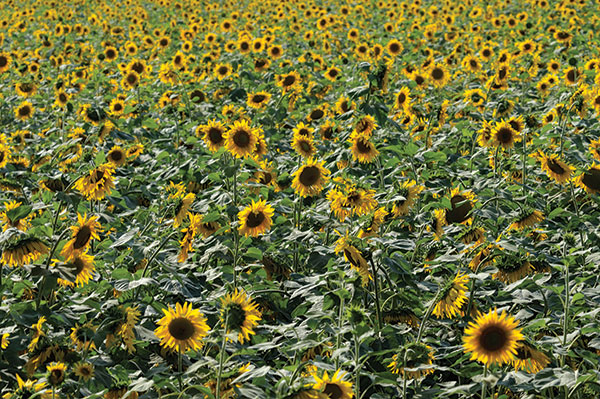 Azerbaijan has a rich flora. Almost all types of plants, found in the world are spread on the territory of this relatively small country. Nearly 4500 species of higher, spore-bearing flowering plants belong to 125 types and 920 genera. Azerbaijan is richer than any other Caucasus country by the total number of species. The republic accounts for 66% of all plant species found in the Caucasus. Along with plant species, widely spread in the Caucasus and other regions, Azerbaijan is also characterized by nearly 240 species of endemic plants. The vegetation spreads in accordance with the physical and geographical formation of e region, modern climate conditions, vertical zones, and a number of other factors. Thus, plant species of desert and semi-desert and mire vegetation covers the plains to a height of 200 meters.
Desert-type plants are found on the Caspian seashore, south-eastern Shirvan, Mil, Mugan, and Shirvan. Depending on the salinity of soils such plants as garasoran, shahsevdi gishotu, are widely spread in these regions. Semi-desert plants are widely spread in Shirvan, Salyan, Mugan, Mil, and Garabagh steppes, as well as in Djeyranchol, Qobustan plains and plains around the Araz. Absinth semi-deserts as zonal formations, dominate Kur-Araz, Qobustan, and Djeyranchol plains. Among other formations, garagan (Kur-Araz) and dengiz (Gobustan, Nakhichevan) are typical for Azerbaijan. Other widely spread plants of semi-deserts are bulbous bluegrass, Japanese brome, berk guramat, eastern bozag, chilingburnu, and a number of salinity herbs (cheren, shahsevdi, saltwort, gishotu. Tughai forests are peculiar of these areas. The forests covering the valleys of the Kur, Araz, and Qabirri rivers contain such trees as oak, willow, birch-tree, ash-tree, etc.
Foothill plains of Major and Minor Caucasus are mainly covered with annual and perennial xerophytic plants and bushes at a height from 200 meters up to 600-700 and sometimes even 1200 meters. The area above (up to 1800-2000 meters) is covered with forests.
Azerbaijan has an area of 86.6 million hectares, with 1213.7 thousand hectares of woodlands. Thus forests account for 989.5 thousand hectares or 11.4% of the total area of the country. Per capita area of forests equals 0.12 hectares of land that is by 4 lower than the average global indicator (0.48 hectares).
Though Azerbaijan's forests occupy a relatively small area they are rich in species of trees. There are 435 tree and bush species with 70 species of endemic ones. The country is characterized by broad-leaved forests. Such forests are widely spread on the Major and Minor Caucasus and Talysh mountains. At a height of 600-1600 meters above sea level, they form a single zone. In other areas, they are preserved in glades and narrow strips.
The forests are formed by three main types of trees-beech-tree, hornbeam, and oak. They make up 86.2% of woodlands. Besides, forests also contain such broad-leaved trees as maple, elm, lime-tree, alder-tree, poplar, yalanyarpag, willow, etc. Needle-leaved forests account for 1.7% of the total area of forests. 7 species of needle-leaved trees out of 107 species of trees are naturally grown in the country. These are garajokesi, Eldar pine-tree, hooks pine, polycarpous, red, and uzungovdeli juniper trees.
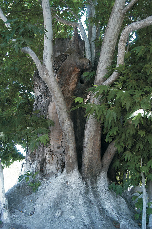
Azerbaijan is home to a number of rare trees and bushes. Garajoke is a rare relict tree of the Tertiary period. It is widely spread in the south (Qabala) and south-east (Pirqulu and Shamakhy regions)of the Major Caucasus. Though slow-growing yet long-lived garachohre does never cover large areas. Eldar valley of Djeyranchol foothill is home to Eldar pane-tree. Among relict and rare trees of Tertiary period iron-tree, Lenkeran acacia, chestnut-leaved oak, zelkova, Caucasus date palm, box-tree, wing nut, Hirkan fig-tree, Hirkan birch-tree, etc are rare patterns of nature.
Fauna
 Azerbaijan situates at the junction of a number of zoogeographical zones, characterized by a specific fauna. The animals from Iran, Central Asia, and the Mediterranean Sea have been adapted to Azerbaijan thus enriching its nature.
Due to the diverse natural conditions, Azerbaijan formed a colorful animal kingdom.
97 species of mammals, 357 species of birds, 67 species of amphibians and reptiles, 1 species of roundworm, 97 species of fish, more than 15,000 species of invertebrates are known in the country.
The fauna of plains is represented by a great number of mammals, reptiles, amphibians, and numerous sedentary and migrant birds
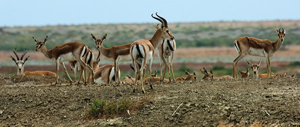
One can come across such mammals as jeyran gazelle, wild boar, wolf, fox, badger, cane cat, rabbit, etc, reptiles as a swamp, Caspian and Mediterranean tortoise, striped lizard, ordinary and water grass-snake, adder, etc, amphibians-different species of tortoises, insects, birds-pheasant, partridge, turaj, different kinds of ducks and geese, loud and hissing water birds, coot, eagle, gallinule, heron, cormorant, pelican, etc.
Besides animals found in plains and mountains, these areas are also characterized by such animal species as East Caucasus billy-goat, Caucasus roe deer, Caucasus chamois, Caucasus tetra, Caucasus donkey, etc.
The Red Book of the Azerbaijan Republic comprises 108 animal species, including 14 species of mammals, 36 species of birds, 13 species of reptiles and amphibians, 5 species of fish, and 40 species of incests.
The minerals of Azerbaijan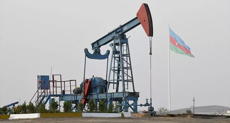
The country is rich in three types of mineral products that are metallic, non-metallic, and combustible mineral products.
Azerbaijan is famous for its oil and gas deposits. 2/3 of the republic is rich in oil and gas. The Absheron Peninsula, Caspian shelf, Baku, and Absheron archipelagoes account for the most part of deposits. Southeastern Shirvan, Central Aran, Gobustan, Jeyranchol, Ajinour, and Siyezen are rich in oil.
The world-famed oil of Naftalan cures a number of diseases.
Gas deposits are found in Gatadagh, Caspian shelf, Baku, and Absheron archipelago. The region of Minor Caucasus accounts for the most part of metallic minerals: iron, manganese, titanium, chromium, copper, cobalt, complex ore, antimony, gold, silver, molybdenum, etc. The biggest deposit of iron was found in Dashkesen.
Among non-metallic minerals limestones of Gobustan, Absheron, Tovuz, travertine stones of Kelbadjar and Shahtakhty (Nakhichevan AR), marble of Dashkesan, gypsum of Upper Aghjakend, alums of Hajyveli, and of great industrial importance.
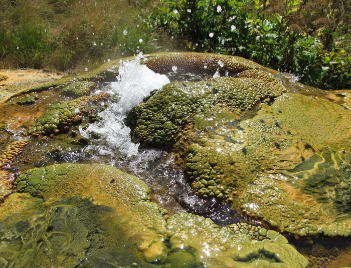
The country is also rich in mineral waters, with different chemical ingredients. Due to that Azerbaijan is called the museum of mineral waters. Istisu (in Kelbedjar), Badamly, and Sirab (in Nakhichevan AR) are famed mineral waters.
Surakhany and Shykh of Absheron peninsula, Qalaalty, of Devechi district, Turshsu of Julfa district are used as a treatment of a number of diseases. Thermal waters dominate the Talysh mountains and southern and northeastern slopes of Major Caucasus
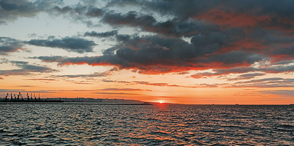
 The Caspian Sea
The Caspian Sea, the largest enclosed water basin in the world is of great importance for the Azerbaijani people. It has unique physical and geographical properties, It should be noted that the flora and fauna of the Caspian Sea are rich in endemic species. For example, 90% of the total reserves of sturgeon, differing from other fishes by its antiquity, are found in this sea.
The specific geographical landscape created favorable recreational conditions.
The sea stretches along a meridian in the shape of the Latin letter "S" and it locates between latitude 47'17" north and longitude 36'33" east. The sea across the meridian stretches to nearly 1200 km, its average breadth is 310 the maximal and minimal breadth id 435 and 195 accordingly. As the level of the Caspian Sea changes periodically, the volume of water and its boundaries are also changeable. At present, the level of the sea is 26.75 meters below sea level. At this level the area of the sea is 392600 km2, the volume of water is 78648 km3. This volume makes up 44% of the total water reserves of all lakes in the world. Its maximum depth is 1025 meters and due to that, the sea rivals the Black Sea, Baltic Sea, and the Yellow Sea and it is even deeper than the Adriatic Sea, Aegean Sea, Tiren Sea, and the Sulu Sea.
Caspian Azeri Sector occupies central and southern parts of the Sea. Caspian Sea water differs from that of the world ocean by its salinity. The salinity totals 5-6 ppm in the north and 12.6-13.5 ppm in the south. 170 out of 300 mud volcanoes in Azerbaijan are located in the Caspian Azeri sector. The number of volcanoes is higher in the South Caspian Sea.
The uniqueness and colors of natural conditions promoted the preservation of a number of rare flora and fauna species in the Caspian Sea up to the present day.
The Caspian Azeri sector accounts for 171 species of phytoplankton, 40 species of animal plankton, 258 species of fitdentos, 91 species of macrozoobenthos, and 80 species and subspecies of fish belonging to 14 families.
Carp-like fishes are the most numerous species-42 species, they are followed by gudgeons-31, herring-17, salmon fishes-2, sturgeon-5 species. The fish fauna of the Caspian Sea comprises 4 genuses, 31 species, and 45 subspecies of endemic fiches. Most endemic fishes are registered in the central part of the Caspian Sea.
Approximately 40 species and subspecies of fish play an important role in fishing. Flock accounts for the biggest part of the total fish fauna (80%) the remainder part comprises herring, grey mullet, friar, argentine, and gudgeon. The Red Book of the Azerbaijan Republic includes the following species of rare and endangered species: stone-eel, sig, Southern Caspian white-eye, chekhon, sea pike-perch. In the last few years, the number of all kinds of sturgeon (beluga, spine, long-nosed sturgeon), Caspian salmon, white salmon, khramulya, shamai fish, shibrit, garasol, is decreasing rapidly and these fishes are on the verge of extinction. The seal is the only mammal found in the Caspian Sea. It is the smallest kind of all existing seals. The number of Caspian seals decreased from 1.5 million in the early 20th century down to 360-400 thousand in 1980th. The Caspian seal was included in the Red Book in 1993.
302 species of birds have been registered on the Caspian Sea and its coastal regions: these include 37 species of water birds, 109 species of birds populating areas around water basins, and 156 terranes birds.