


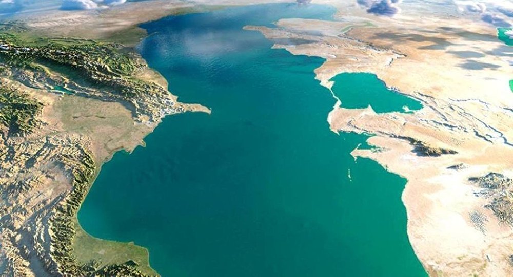
Both meteorological conditions and climate over the Caspian Sea and adjacent regions are determined by air circulation over the Eurasian continent, as well as by the coastal area relief and sea-level fluctuation. Cold Arctic air masses come over the sea during the winter seasons. At the same time, air masses come down during the winter seasons over the sea from mountainous areas of Iran. Both of these high-pressure convergent air masses drive cyclones over the central part of the sea. Moreover, cyclones generated over the Black and Mediterranean Seas also have their impact on the Caspian weather. Siberian and Mediterranean anticyclones are capable of moving to the east and northwest in the summertime, and by doing so, causing frequent changes in the distribution of air masses. The temperature contrast became balanced during summer times that attenuates circulation between atmospheric lower and upper strata. During this season synoptic processes over the Caspian Sea go through the dominant impact of Azor maximum pressure. Close to the middle of the fall Azor maximum impact diminishes and finally, continental atmospheric masses invade the area to cause westward atmospheric movement activation.
Due to the relatively lower latitudinal position of Caspian Sea surface subjects to extensive solar radiation resulted in a positive radiation balance that estimated value measures 60 kcal/sq cm.
Middle and South Caspian offshore regions fall into moderate and subtropical climate zones, whereas its northern part falls into continental one.
Air temperature
Due to the vast latitudinal extension of the Caspian Sea (1300 km) itself and its drainage area (3000 m) and because of its deep inland position its climate has strong continental climate characteristics. During winter seasons the average monthly temperature within the northern Caspian varies in the range from -8 C to -10 C, whereas its value is positive and varies in the range from 8 C to 10 C within its southern part. During summer seasons air temperature discrepancy between its north and south sectors gets relatively smaller (24-25 C and 26-27 C in the south).
The winds
The most typical hydrometeorological feature of the Caspian Sea is the winds. The winds dominantly blow from the north, and they sometimes appear like a hurricane which speed reaches 35-40m/sec. The second trend of the winds due to recurrence frequency is the eastern one. Most frequently windy days are observed within the Absheron Peninsula and Mahagegala-Darband regions. Moderate and strong winds are frequently observed during the fall and winter seasons. Absheron Peninsula is characterized by the north wind that is called "Khazri".
Atmospheric precipitation
Atmospheric precipitation does not equally distribute over the Caspian offshore area. Average annual atmospheric precipitation measures as much as 100 mm. Atmospheric precipitation spatial annual distribution is defined dominantly by coastal relief and actually represented as follows: 300 mm in the north, from about 300-400 mm to 600 mm in the west, 1600 mm within the southwest Caspian area, whereas only nearly 90 mm within its eastern area. Approximately 200 mm of atmospheric precipitation is observed within the Absheron Peninsula.
Water temperature
The average yearly Caspian water temperature during winter seasons within its northern and southern parts approximates to 0 C and 10 C. During summer seasons these discrepancy value decreases and its temperature values reaches up to 25 C and 26 C, respectively. The average annual water temperature within the middle Caspian offshore areas measures 14-15 C, whereas, its winter and summer temperatures measure 6-7 C and 23-24 C, respectively. Deep in the seawater column, its temperature measures 5-6 C and is suggested to remain unchanged. During the spring season positive temperature anomalies are observed within the Caspian eastern shelf areas, nearby Bekdash town shelf area.
Water salinity
Caspian water salinity in the northern sector within the Volga River vicinity amounts to 0.3 ppm and therefore it referred to the typical freshwater basins. 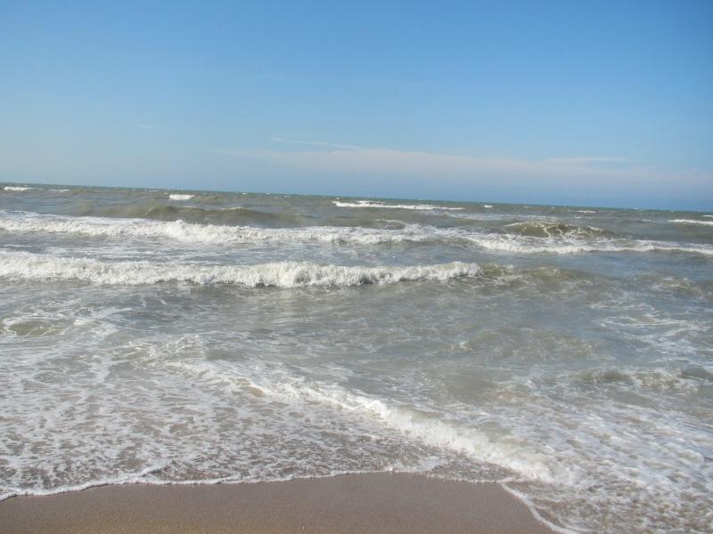 However, its salinity dramatically increases, and at a 100 km distance off it reaches 10 ppm. The average annual salinity increases up to 12.5 ppm and 13.0 ppm in the west and east margins, respectively. In some cases, in the southeast, its salinity measures 13.5 ppm, whereas within Gara-Boghaz-Gol gulf its value exceeds 300 ppm. Caspian water salinity increases in winter seasons and decreases in summer seasons. The reason for this is the fact that during the winter seasons Caspian water density increases due to the shortage of the Volga River run-off caused by its freezing.
The marine currents
Caspian water keeps moving continuously. Generally speaking, its water movement resembles a counter-clockwise rotation of a cyclone. At the same time, some emphasis should be given to its particular features. North Caspian currents trending southward are dominantly caused by the Volga River water flowing inertia. As a whole, the main reason that causes the Caspian Sea currents is thought to be the winds, that is, currents here are classified as a drifter type. The temperature discrepancy that existed between the north and the south Caspian sectors cause density discrepancy. The latter one, in its turn, causes density gradient flow. Density gradient flow basically comes into effect during the winter seasons. The reason for this is the temperature discrepancy increment between the north and south Caspian sectors. Surface currents within the middle and south Caspian sectors cause cyclonic whirlpools. Typical current speed value in the Caspian Sea varies in the range from 15-20 cm/sec, whereas this value reaches 100 cm/sec in between Chilov Island and Neft Dashlary oilfield.
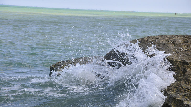
Sea waves
The Caspian Sea keeps dynamic continuously. During 250 days of the year, strong and moderate winds blow causing long and high amplitude waves on the water surface. 6 point magnitude waves are frequently observed from November to March. 8-10 m high and up to 100-150 m, long strong waves can be observed within the middle Caspian sector, as well as around Absheron Peninsula and Mahagegala town. The relatively quiescent sea period lasts from May to August.
Freezing
North Caspian Sea offshore area freezes and is covered by an ice sheet during winter seasons. Sea surface begins to freeze in the middle of November during usual weather conditions. The freezing pattern southern border coincides with the line extended from Chechen Island to Mangishlaf Peninsula. During severe winter seasons, sea freezing was observed along Absheron Peninsular and ice block drift had been observed six times around the Absheron Peninsula.
Sea level fluctuation
 One of the profound features distinguishing the Caspian Sea from other large inland basins is the fact of its sea-level significant fluctuation. Caspian Sea level fluctuation value is estimated within the 15 m range during the last 3000 years based on paleo-geographic, archaeological and historical evidence. Monitoring of the Caspian Sea level fluctuation was established by academician C. Lents in Baku in 1837. During this monitoring period, the highest sea level (-25.2 m) was observed in 1882, and its lowest level (-29.0 m) was observed in 1977. It is seen that during this observation period sea-level drop was measured at 3.8 m. It is noteworthy, that there were several rises of the sea level over the cumulative sea-level drop. 2.5 m rise of the sea level observed during 1978-1995 has resulted in the sea level mark measured at -26.5 m.
There are contradictory points of view associated with the comprehension of a driving mechanism causing sea-level fluctuation. Nevertheless, it should be noted, particularly, that most of the geologists adhere to the idea of dominant climate impact, that is, the main reason for the sea-level fluctuation is a climate factor. No doubt, that geologic and anthropogenic factors should also be taken into account. Climate factor influence is observed on the Caspian Sea water balance income (run-off of the rivers flowing into the Caspian Sea and atmospheric precipitation falling over the sea surface) and discharge evaporation from the sea surface). Sea level change occurs as a result of this balance distortion, that is, in cases when rivers run off and atmospheric precipitation dominates then the sea level rises, and vice versa.
Owing to the fact that the sea level fluctuation basically depends on the climate processes as well as the impossibility so far to forecast climate variation, therefore long-term sea-level fluctuation forecast is impossible too. All previously done prognoses on the point appear to be just stochastic.