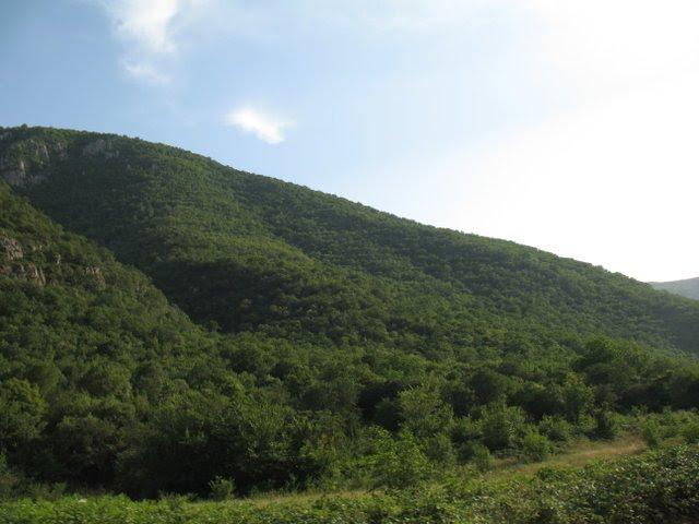
Year of foundation: 1974
Area (hectare): 107
Location: Within the territory of Zangilan administrative district, Basut-Chay valley
Description: The Basut-Chay State Reserve was established for the protection of a unique plane-tree grove. In October 1980, the area of the reserve was reduced by 10 hectares. It is consisting of Quercus Iberica and Caucasian hornbeam, while on the hilly plateau of the left bank, a forest of Celtic Caucasica and Indian Juniper (Juniperus polycarpos), Pistacia, and others are developed. Platan trees have an average age of 170 years; however, there are some real giant trees, which are up to 1,200-1,500 years old. The height of these trees is 50 m with a diameter of up to 4 m. The main protected object is the unique plane-tree grove, which is the biggest in the world. Five settlements were located around the reserve, inhabitants of which traditionally considered this plane-tree grove as their private plots.
Name: Gara-Yaz State Reserve
Year of foundation: 1978
Area (hectare): 9658
Location: Within the territory of Gazakh administrative district, on the bank of the River Kura in the Agstafa forestry
Description: The Gara-Yaz State Reserve for the protection and restoration of the Kura tugay forests. The Gara-Yaz reserve is in the western part of Azerbaijan. Its territory covers the flood lands of the River Kura and the Gara-Yaz Lowland on the left bank of the River Kura. In the region where the reserve is situated, the tugay forest and steppe lowland landscapes are typical. In the past, a continuous line of tugay forest extended along the middle and lower reaches of the River Kura, which was surrounded by forest to an extent of 600 km. The territory of the reserve is part of the quaternary accumulative lowland, sloping slightly to the River Kura. Here the climate is that of moderate warm semi-desert and arid steppe, for which a warm and dry summer and moderate winter are typical. The main protected objects are the biggest tract of tugay forests of the middle reaches of the River Kura and the rare and endangered ecosystems of tugay. Along the river, shrubbery of willow, hawthorn, barberry, Elaeagnus, and others grow.
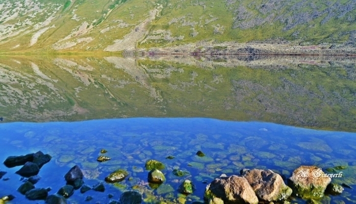 Name: Gara-Gel State Reserve
Year of foundation: 1987
Area (hectare): 240
Location: Within the territory of Lachin administrative district, on the border with Goruss district of Armenian Republic
Description: The Gara-Gel State Reserve was established for the protection of the unique ecosystem of the rare mountain Lake Gara-Gel, which is of glacier origin, and to guarantee the safety of the surrounding natural complex. Lake Ishigli-Gara-Gel is situated at a height of 2, 658 m above sea level in the southern part of the Karabakh volcanic plateau near the foothills of several mountains with a height of 3, 200-3, 500 m. the lake is a relict water reservoir, which was formed in the crater of an extinct volcano. The length of the lake is 1,950 m, its maximum width is 1, 250 m, length of its coastline is 5, 500 m, maximum depth – 7.8 m, volume of water – 10 million m3, area of the lake 13 km2. Water flow is mainly due to melted snow and rainwater, partially spring water. In terms of botany and geography, the Karabakh Plateau is situated between the Caucasian and Armenian-Iran provinces, which determines the specifics of the local flora. The flora of the reserve includes 102 species and subspecies of vascular plants from 68 general and 27 families. The lack of flora is explained by the fact that the reserve covers only the lake, and many rare and endemic species grow beyond the reserve area, but close to its borders. The vegetation of the coastal area of the lake is represented mainly by meadows with the dominance of Trifolium and Tragacantha and Astragalus. The swamp flora and vegetation are limited because of the height of the area. There are only two species of plants in the lake: Polygonum amphibian and Ranunculus. In 1967, a type of Sevan trout, included in the Red Book, was introduced into the lake. The reserve is an inter-republic reserve. It should be noted that adjacent to the borders of the reserve there are areas with rare and endangered species of plants such as Euphrasia, Potentilla, and others.
Name: Gyzyl-Agach State Reserve
Year of foundation: 1929
Area (hectare): 88360
Location: Within the territory of Lankaran administrative district, in the Great Gyzyl-Agach bay
Description: The Gyzyl-Agach State Reserve is situated on the southwestern coast of the Caspian on an area of 88.4 thousand hectares including 62 hectares of water area. It was established in 1929 for the protection and reproduction of wintering and migratory waterfowl, wader, and steppe birds. In 1975, the reserve was classified as being of international significance, mainly as a habitat for waterfowl and coastal birds. The territory of the reserve is an important place for the rest and wintering of migratory birds in the Caspian region, where many bird species from northern Europe stay. A typical feature of the Gyzyl-Agach reserve is the extreme dynamic connection between the variation in the level of the Caspian Sea, the wandering of the Kura and Araks River beds, and anthropogenic activity. At present, the territory of the reserve is coastal lowlands, which are below sea level and with a different set of natural and artificial water reservoirs. The maximum height is in the Kulagin area in the center of the reserve – 24.5 m below sea level; the minimum height varies depending on the level of the Caspian and during the period of the reserve’s existence has ranged from 26 to 29 m; in 1995 it was 26.4 m. At present, the relief of the reserve is characterized by the alternation of low (up to 1 m) ridges and open hollows, and old silty riverbeds. In some places there are separated former riverbeds – akhmazes; for the northern part, Ishores plain lowlands with salines are typical. There are 248 species of birds in the reserve, including Francolinus francolins, grey goose (Anser anser), white-fronted goose (Anseralbifrons), Little bustard (Otis tetrax), Plegadis falsinellus, Platalea leucorodia, Nycticorax nycticorax, Phoenicopteri, Branta ruficallis, peregrine falcon (Falco peregrinus), Pelecanidae, buff-backed herons (Cochlearis cochlearis), pond herons (Ardeola ralloides), swans and others. The rise in the level of the Caspian has resulted in the formation of vast shallow gulfs with rich feeding grounds, due to which the number of wintering waterfowl has increased. The great concentration of ducks and coots on the open areas of the gulfs, pink flocks of feeding flamingos (Phoenicpteri), white clouds of swans, white herons standing alone in the water. Rallidae and numerous other Limicolae and typical features of a winter view of the Gyzyl-Agach reserve. On the migration route along the western coast of the Caspian great flocks of migratory birds feed and rest. Ducks and swans are attracted by the shallow waters that are rich in sub-water vegetation and mollusks. Flocks of geese and little bustard (Otis tetrax) feed in semi-deserts. The mild climate creates favorable conditions for the wintering of hundreds of bird species. In some years 5-7 million birds have wintered here. There are also wild boar, wolf, jackal, jungle cat, badger, otter, fox, and other mammals. There are 54 species of fish in the waters of the reserve: sazan, pike perch, Rutilus frisii kutum, Mugilidae, Salmonidae, and others.
Name: Ilisu State Reserve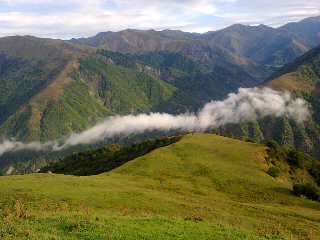
Year of foundation: 1987
Area (hectare): 17381,5
Location: Within the territory of Gakh administrative district, southern slope of the Major Caucasus
Description: The Ilisu State Reserve was established for the protection and restoration of the natural complex of the central part of southern macro-slopes of the Greater Caucasus; the preservation of species of flora and fauna, and the localization of centers of erosion to lessen the threat of mudflows. The relief is formed by a combination of mountain ridges and deep river valleys. The climate is conditioned by the geographical location of the territory, which is protected from the north by the Major Caucasus Ridge, the area’s height amplitude, and the highly indented relief. The favorable climatic conditions (soft winter, mild summer, warm spring and autumn, plenty of precipitation during the vegetation period, absence of prolonged droughts, and strong frost) contribute to the forming of luxuriant vegetation, particularly, forest vegetation. The main protected objects are the natural complexes of the middle area of the macro-slopes of the Greater Caucasus. On the territory of the reserve, there are about 300 vascular plants with more than 90 species of arboreal-shrub type. The flora of the reserve includes medicinal (about 50 species), endemic, rare, and endangered species. The yew-tree (Taxus baccata) and Raddle birch are included in the Red Book. 93% of the state reserve is under broad-leaved forests, where oak, beech, and hornbeam are dominating. Also, there are lime, nut, chestnut, ash, maple, etc. More than 150 species of vertebrates inhabit the territory of the reserve and its fauna is the same as that of the southern slopes of the Greater Caucasus Range. On the territory of the reserve, there are aurochs, deer, chamois, roe, bear, wild bear, marten, and others. Its rivers are inhabited by Forea, Barbus, etc. Amphibians are represented by the tree frog, green and common toad, frogs of Asia Minor and Caucasus. Reptiles are represented by 12 species. The territory of the reserve is inhabited by more than 90 species of birds belonging to 11 orders: black hawk, goshawk (Accipiter gentilis), kite, golden eagle (Aquila chrysalis), Gypaetus peregrinus, bearded vulture (Gypaetus barbatus), black vulture (Aegypius monachus), peregrine (Falco peregrinus), eagle owl (Bubo bubo), long-eared owl (Asio otus), scops owl (Otus scops), Picnae, etc. There are more than 60 species of migrant birds. Six species of vertebrates are included in the Red Book: wood snake (Coluber), golden eagle (Aquila chrysalis), bearded vulture (Gypaetus barbatus), duck hawk (Falco peregrinus), etc.
Name: Turian-Chay State Reserve
Year of foundation: 1958
Area (hectare): 22488
Location: Within the territory of Agdash, Oghuz, Yevlakh, Gabala administrative districts, on the right bank of the River Turian-Chay
Description: The Turian-Chay State Reserve was established for the protection and restoration of arid-arch light forest and other natural resources; and for the localization of centers of erosion at the foothills. The reserve is situated on the spurs of the Buz-Dag Ridge, in the southern foothills of the Major Caucasus, on the right bank of the River Turian-Chay in the Agdash area of the Republic. Its territory lies at a height of 400-650 m above sea level and extends for 35 km from east to west and for 5 km from north to south. The reserve is situated in an area of semi-desert and arid light forests, which mainly consist of pistachio, juniper, oak, having an important soil protecting, water protecting, and climatic significance. In the relief of the reserve lowland mountains dominate with the peaks: Pirsei-Dag (609 m), Nulbon-Dag (437 m), Archan-Dag (476 m), Olmes-Dag (544 m), and others. As a rule, they have steep, in some places denudated eroded slopes, and are separated by deep narrow valleys. The northern slopes are more gentle and covered with forests; the southern slopes are steep and strongly eroded. The general process of wind erosion has developed on the territory of the reserve. On the territory of the reserve, 60 species of trees and bushes grow. The main types of sparsely growing trees are Pistacia, fudian juniper (Juniper polucarpus), prickly juniper (Juniperus oxicedrus), Quercus Iberica, ash-tree, Celtis caucasicus, and pomegranate. Moreover, Quercus Iberica, Populus, willow, alder, Elaeagnus, and other trees also grow in this area. Two dendraflora species of the reserve – Juniperus and pomegranate are included in the Red Book. There are 24 species of mammals and 112 species of birds, 20 species of reptiles, and 3 species of amphibians in the reserve. Among the birds, there are partridge (Alectoris kakelik), Columbia formes, Cercheneis tinnunculus, griffon (Gyps fulvus), black vulture (Aegypius monachus), and others. Among mammals, there are wild boar, brown bear, badger, stone marten, lynx, jackal, European wild cat, hare, and others. Among reptiles, there are Coluber jugularis and Vipera lebetina. Along the former river- beds and channels the Caspian turtle can be found, and on the slopes of the mountain the Mediterranean turtle can be observed, which, as well as the Coluber caucasicus, is included in the Red Book. The main protected objects are the model natural complexes of the Boz-Dag Ridge with the developed pistachio-arch light forests, area of semi-desert, arid, and tugay vegetation. The state of arid light forest on the Boz-Dag is of great concern primary primarily because in spite of the productivity of the majority of tree species, including juniper, the regeneration of these forests, in general, is very slow. The establishment of the Turian-Chay reserve brought -an improvement in the situation with the regeneration of these forests. During the 40 years of the reserve’s existence, the pistachio-juniper light forest has extended its area and the general quality of trees has increased. The replacement of juniper by pistachio has almost stopped. Shrubbery and herbage lave also developed well, considerably reducing the process of soil erosion.
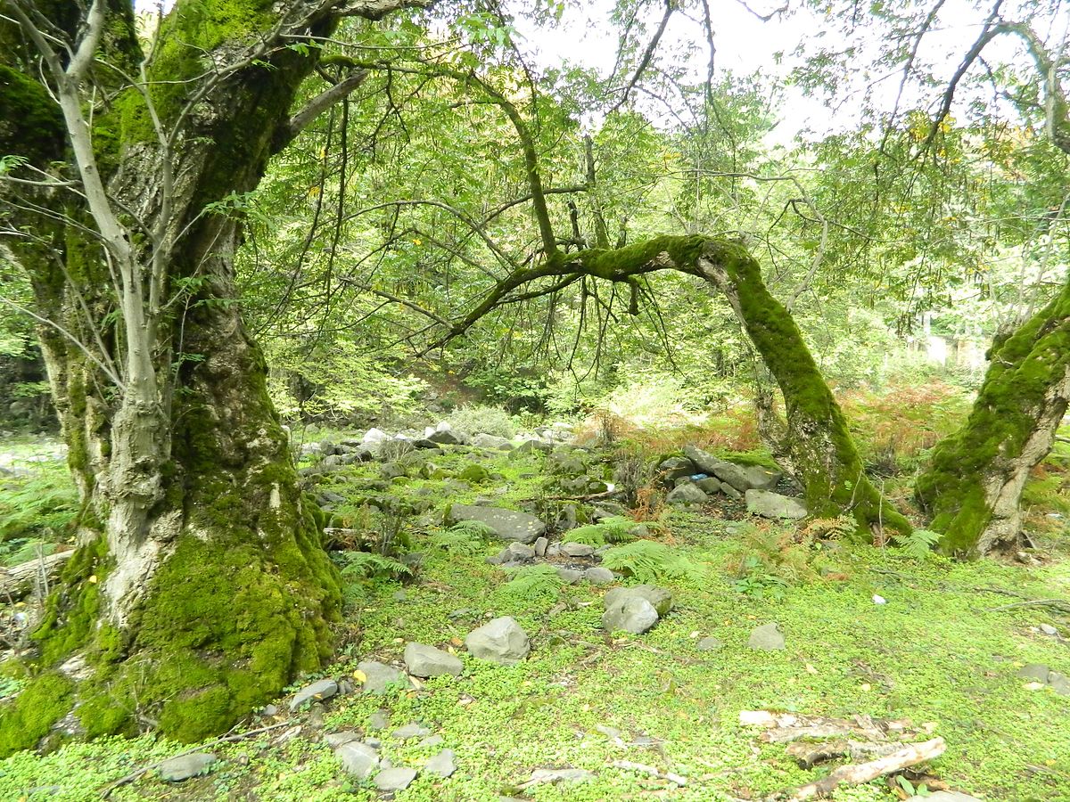
Name: Zagatala State Reserve
Year of foundation: 1929
Area (hectare): 47349
Location: Within the territory of Zagatala and Balakan administrative districts, on the southern micro slope in the middle part of the Major Caucasus Ridge
Description: The Zagatala State Reserve was established on an area of 25218 hectares, including 48 hectares of water reservoirs. During the period of its existence, the reserve has belonged to different organizations and its area and borders have been changed. The reserve is situated at a height of 650 – 3,646 m above sea level. The reserve territory has a complicated relief due to spurs of the major ridge extending to the south and south-east: Agkemal, Katslar, Rochigel, Pichgel, Khalagel, Ruchug, Mrovdag, and others, which are separated from each other by deep river valleys (canyons). Slopes with a steepness of 40-80 m and more occupy an area of more than 450 hectares; slopes with a steepness of 25-40 m prevail. The relief reflects the activity of glaciers and other forms of erosion. The asymmetry of the river basin is typical: the mountain slopes, deep canyons, and valleys are sharply shaped. The Zaqatala reserve was organized with the purpose of protecting and studying the fauna and flora of the southern slopes of the Major Caucasus. The reserve territory is referred to by botanists as the Iberian area of the Caucasus flora province. At the end of the Tertiary period, the forests of this area had a different composition, with a considerable touch of elements of the Hirkan forests, and were much richer than the present ones. The contemporary flora of the reserve has more than a thousand species. Such representatives of ancient plants as rhododendron yellow, Laurocerasus officinalis, Caucasian bilberry-bush, Taxus baccata, maple, Polypodiophyta, and others are preserved on this territory. The main forest–forming species of the reserve – Fagus Orientalis, as well as Quercus Iberica and Corylus colurna are also referred to as ancient plants. The representatives of rare plants: Taxus baccata, apple tree, ash tree, birch tree, cherry tree, pear tree, and others are observed as well. The fauna of the reserve is rich in species composition. They are Dagestan aurochs, chamois, red deer, roe, brown bear, fox, badger, Mustela nivalis, pine marten and stone marten, lynx, squirrel, and others. There are 104 species of birds, including some birds of prey: long-eared owl, golden eagle (Aquilla chrysaetos), Cerchneis tinnunculus, Neophron percnopterus, griffon (Gyps fulvus), bearded vulture (Cypaetus barbatus), black vulture, and others. There are some rare, specially protected species of birds: bearded vulture (Gypaetus barbatus), golden eagle (Aquilla chrysaetus), peregrine (Falco peregrinus), Tetraogallus, Accipiter badius, which are registered in the Red Book.
Name: Korchay State Nature Reserve
Year of foundation: 2008
Area (hectare): 4833,6
Location: Within the territory of Goranboy District
Description: By Decree No 2745 of the President of Azerbaijan Republic dated April 01, 2008, in the administrative area of 4833.6 ha of Goranboy Korchay State Natural Reserve was established. The main purpose of the establishment was the preservation of Bozdagh natural landscape, rare and endangered animal species. The land cover consists of ordinary and light brown, partly alluvial-meadow soils of different degrees. The landscape consists of the plains, hills, and low mountains (Bozdag) areas. Semi-desert and dry steppe climate with dry winters dominate in the area. Vegetation consists of wormwood plant groups, plants of the river deposits, ephemerides. The natural landscape of these areas is of great importance for animals and birds. From animals that were included in the "Red Book" gazelle and partridge can be noted particularly. From mammals, gazelles, hares, foxes, jackals, wolves, birds partridge, etc. are spread here.
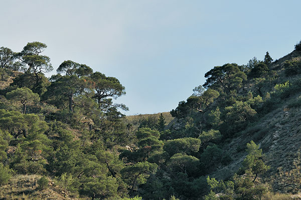
Name: Eldar pine-tree State Reserve
Year of foundation: 2004
Area (hectare): 1686
Location: Within the territory of Samukh administrative district.
Description: The Eldar pine-tree State Reserve was established to preserve the genetic heritage, biological diversity of ecological systems, unique forests of Eldar pine trees. The pine trees growing here are 100-120 years old and 2-6 m high. Fauna in this reserved area is not very variable – among animals, only hares inhabit here and among birds – partridges. Eldar pine tree is included in the Red Book of Azerbaijan Republic.
Name: Shirvan State Natural Reserve
Year of foundation: 1969
Area (hectare): 6232
Location: Within the territory of Salyan and Neftchala administrative districts
Description: The reserve was established in a part of Bendovan State Nature Reserve for the purpose of protecting and increasing the number of gazelles and water birds. The area of the reserve was expanded to 25.8 thousand hectares in 1982. Water reserves account for 3.5 hectares of the area. The reserves are characterized by rich ornithological fauna. Rare and valuable birds nest and winter in the swampy areas. The biggest part of the reserve was transferred to the Shirvan National Park in 2003 and the area of the reserve currently totals 6232 hectares. Shirvan National Park was established by a decree of the president of Azerbaijan on July 5, 2003, and thus the area of the reserve remained changeless.
Name: A group of mud volcanoes of Baku and Absheron State Nature Reserve
Year of foundation: 2007
Location: Baku and Absheron peninsula
Description: A group of mud volcanoes of Baku and Absheron State Nature Reserve was established in 2007. Azerbaijan is known as a unique and classic region of the development of mud volcanoes on the Earth. More than 300 mud volcanoes out of 800 on the planet are located on the east and the bordering area of the Caspian Sea. Most of the mud volcanoes were spread in Baku and the Absheron peninsula and some of them considered a natural monuments. With full firmness, Azerbaijan may be called the land of volcanoes and these volcanoes are our national and natural wealth. For natural appearance and characteristics, 23 mud volcano was given a status of the geological natural monuments, in order to organize reliable protection of the mud volcanoes in the Ministry of Environment and Natural Resources " The Scientific Coordination Council on Mud volcanoes "was established with the participation of specialists of the National Academy of Sciences.


