


The diversity of reliefs in the territory of Azerbaijan is typified by their origin. The following types of relief may be found generated in the area tectonic, volcanic, pseudo volcanic, nival-glacier, gravity-driven, fluvial, arid denudation, eolian, karst, talus, etc.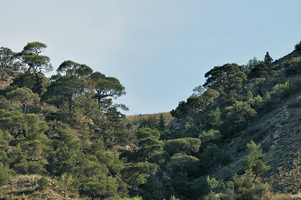
Tectonic relief has been formed in every single area of the Republic. Most general background and profound terranes (Great Caucasus, Minor Caucasus, and Talish mountain systems, Kur River lowland) have resulted due to recent tectonic movements. It is suggested that in recent fold areas (Jeyranchol and Ajinohur fore range areas, Gobustan, Absheron Peninsula) all relief features are associated with the tectonic movements. Volcanic relief is more typical for the Garabagh plateau terrane. Relief forms in these areas are dominated by lava and scoria cones, staggered lava plateaus, and volcanic flows. Lake sags and hanging bogs were formed in areas where lava flows intersected with riverbeds. Volcanic outbursts that occurred in the high mountain cold climate environment led to the formation of pebble deposits by abrupt lava cooling and splitting.
Pseudo volcanic relief formation has been formed as a result of mud volcanoes activity. Such relief features within Gobustan, Absheron Peninsula, southeast Shirvan plain, and other areas such as offshore Baku Archipelago are typical and occur like and cones and coniform hills, Most Baku Archipelago Islands has been generated due to mud volcanoes activity.
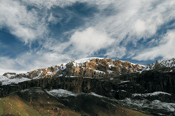
Nival-glacier relief has been formed due to ancient and recent glacier abrasion and accumulation, and appears like a glacial trough, corries, dump moraine, and shoved moraine. Such kind of glacial relief is widespread within the Great Caucasus (Major Caucasus ridge, Lateral ridge) and Minor Caucasus systems (Murovdagh, Shahdagh, Zangazur, Garabagh plateau ) high mountain relief zone.
Gravity-driven relief features consist of landslide and rockfall terranes. Mountain rock falls are dominantly evolved within Great Caucasus Shahdagh and Gizilgaya plateaus, within Minor Caucasus Shargi Goycha, both Murovdagh and Garabagh ridges, and Kapaz Mountain terrane. Several mountain lakes in Azerbaijan (Goygol, Maralgol, Ganligol, etc) were formed as a result of mountain rock falls. Landslides are dominantly pervasive in areas with conducive lithology and hydrogeology conditions within the southeast Great Caucasus (Girdiman-chay, Aghsu) and its northeast sector (Valvala-chay, Gilgilchay, Atachay).
The most widespread type of relief in Azerbaijan is fluvial. Lake Goygol was originated as a result of surface water activity. Such kinds of relief features include riverbeds, terraces, gorges, washout fans (debris cones), deltas, and other erosion and accumulative relief forms.
Arid-denudation has driven relief to evolve within arid regions where loose sand/clay deposits are widespread: Gobustan, west part of Absheron Peninsula, northeast flank of Major Caucasus ridge (the area between Gilgilchay and Sumgayit-chay), Jeyranchol-Ajinohur fore ranges, Nakhchivan AR fore range systems, etc. Those relief terranes are dominantly attributed to badland and clay pseudocyst formation.
Eolian relief forms embrace dunes, sand bars, and cones and coincide with Samur-Davachi lowland, Absheron Peninsula, and southeast Shirvan coastal areas. These relief forms have evolved due to the arid climate environment and the wealth of sand deposits.
Karst relief features can be observed within both Great and Minor Caucasus mountain systems where carbonate deposits crop out to the surface. Their formation was stipulated with surface and ground waters chemical and mechanic impact. Karst relief diversity includes sinkholes, caves, ponors, etc features. Azikh cave, known due to the famous Alm Paleolit archaeology findings, is considered one of the significant karst relief forms.
Talus relief has been evolved due to Caspian Sea abrasion and accumulation activity. The coastal area that underwent Quaternary time transgression demonstrates such kind of relief as beach barriers, terraces, cliffs, benches, and others.
Polygenetic relief forms (dominantly peneplanation planes) are generated due to combining effects of relief forming processes that can be observed within mountain regions.
Anthropogenic (technogenic) relief forms due to irrigation (watering and drainage) systems, civil and military construction (dams, dykes, etc), and other people's activities are most of all widespread within the Kur-Araz River lowland.
Geomorphologic regions
The territory of Azerbaijan has an intricate geomorphologic structure. There are morphologic features that underwent insignificant tectonic impacts such as denudation-structure mountains and those that suffered its strong impact, or erosion-structure mountains, volcanic mountains, accumulation-denudation plateaus, and plains, as well as accumulation plains. Relief origin, its formation age, morphologic features, geologic setting, and their relation to recent tectonic movements made it possible to divide Azerbaijan Republic territory into two geomorphology country 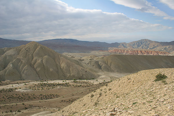 (Cremia-Caucasus, Minor Asia, and four provinces -Foothill Caucasus, Great Caucasus, South Caucasus depression, Minor Caucasus) which includes six geomorphology regions: Samur-Davachi, East Great Caucasus, Kur River lowland, Outside Minor Caucasus, Internal Minor Caucasus, and Talish region which in their own turn embraces sub-region and districts. Sometimes Middle Araz lowland, Zangazur, and Daralayaz ridges, as well as Talish mountain and Lankaran lowlands are included in the Minor Caucasus region as component geomorphology districts, whereas Gusar inclined plain and Alazan-Ayrichay valley geomorphology districts are referred to as the Great Caucasus region.
Samur-Davachi geomorphology region in terms of structural ranking is suggested to be the southeast extension and constituent part of Gusar-Davachi foredeep that took shape during the recent tectonic evolution stage and is located within the Great Caucasus northeast foothills. Its recent surface and basic geomorphologic attributes have been formed due to Late Pliocene and Anthropogenic marine and terrestrial accumulation processes. There are marine terraces, diluvial cones which deposits were shed from Great Caucasus northeast flanks as well as lowland sags in between mentioned cones. Coastal areas are dominantly covered with sands. Its surface is inclined (approximately from 0 to 1900 m high) and is typified by staggered and rolling appearance. Its surface inclination and erosion increase along with elevation increment. Erosion incision reaches 850-950 m within its foothill areas. This region is divided into Samur-Davachi and Gusar geomorphologic districts.
East Great Caucasus geomorphologic region is distinguished from the other geomorphologic regions by more widespread nival glacial and explosion glacial relief. Late Pliocene-Anthropogenic glaciation relics here remained as trough valleys, corries, dump moraine, and small roaches. There also are widespread mud volcanoes, landslides, badlands, and clay karst terranes. Peneplanation plane features are also observed here. Those peneplanation planes caused inclined plain to appear in a staggered mode. The most widespread contemporary exogenic processes are erosion and gravity-driven ones. The region is divided into Major Caucasus ridge southern flank and southeast Caucasus geomorphology sub-regions:
1. Major Caucasus ridge south flank sub-region is located between Mazimchay and Girdimanchay interfluve and is severely dissected by river valleys (incision depth varies from 300 to 150 m). Watersheds are usually narrow, serrate, and elevations are tapered. In some places, there are relatively steep (40-70 C and over), with usually extremely narrow riverbeds. River inlet ravines are usually dissected and complicated by landslides. As ravines got wider there appear terraces. Mud-flows frequently occur there. Rockfalls and detritus materials are also widespread there. Zagatala, Shaki, and Lahij geomorphologic districts are outlined within that sub-region;
2. Southeast Caucasus sub-region includes severely dissected mountain ridges. Major Caucasus ridge is a constituent part of that sub-region and consists of a narrow lateral part and steep (50-70 C) dominantly naked flanks. The westward watershed of the Lateral ridge is divided from each other canyon shape ravines into smoothed large synclinal plateaus (the biggest one is Shahdagh plateau). Severely dissected Lateral Niyaldagh ridge is located on the south. There are several troughs between ridges. Those flanks consist of terraces. Landslides and rockfalls are typical for that terrane. The eastward sub-region includes its native Shamakhy area, as well as Gobustan and Absheron Peninsula. Its subdued relief plateaus embrace Absheron Peninsula. Gizmaydan Shamakhy, Maraza, etc are typified by subdued relief plateaus. Their watershed and flanks are subdued. River beds are usually narrow, but in some places, they pass into relatively large terraced depressions. The northwest part of the sub-region is characterized by landslides and rockfalls, whereas in its southeast part there are mud volcanoes, badlands, and clay karst like arid relief features, and sand dunes are pervasive among Absheron coastal area. There also are salt bottom closed depressions and salt lakes in the area. Such geomorphologic districts as Bazarduzu, Shahnabad-Khizi, Shahdagh, Tengi-Beshbarmag, Dubrar, Shamakhy, Gobustan, and Absheron have been delineated here.
Recent tectonic movements and exogenic relief forming intricate processes have resulted in the diversity of relief forms observed within the Kur River lowland geomorphologic region. It consists of four geomorphologic sub-regions: Alazan-Ayrichay valley, Jeyranchol-Ajinohur fore range, Kur-Araz Rivers lowland, and Minor Caucasus foothill inclined plain.
1. Alazan-Ayrichay valley sub-region in terms of morphology context embraces isolated and subsided inclined foothill plain. Its surface is covered with alluvial-proluvial deposits. Alluvial cones and deposits concentrated between those cones are partially bogged. The predominant process is deposit accumulation. Alluvial cones consist of coarse materials, whereas deposits located between them are fine. Alazan and Ismayilly geomorphology districts are outlined in the sub-region;
2. Jeyranchol-Ajinohur fore range sub-region is located in the north of Kur River valley. Jeyranchol andAjinohur fore ranges located south off Alazan-Ayrichay valley, as well as Langabiz-Alat fore range located in the northeast Kur River valley are also inclined in that sub-region. Its relief consists of ridges, crests, and elevations, as well as valleys and troughs in between reflecting anticlines and synclines respectively. The ridges and crest flanks are asymmetric (consist of Upper Pliocene deposits in its west and east parts and Anthropogenic deposits in its center). Their south flanks are very steep and north flanks are gentle. In some places (Gurjuvan plateau) at a 600-1000 m level, there are peneplanation planes. Sub-region is divided with antecedent valleys of the transversally flowing transit rivers. Incision depth varies in the range from 250 to 700m. The dissection is denser within the south flanks where ravines and gorges of badland-type erosion are underway. Mud volcanoes are observed in the east part. Sub-region is divided into Ajinohur, Langabiz-Alat, and Harami geomorphologic districts;
3. Kur-Araz lowland sub-region is the largest part of the Kur-River valley. Its central part is covered with clay deposits, whereas Late Anthropogenie and Holocene terrestrial and marine clay, sand and pebble deposits cover its marginal parts. Having been young and gently slopping sub-region relict surface is just slightly dissected. East part of the considered region of crests and elevations (Kurovdagh, Babazanan, Mishovdah, Galmas, Bozdagh, Khidirly, Bandovan) caused by recent folding and mud volcanism. The riverbeds are shallow, meandering with accumulation processes underway. Diluvial cones are met within Shirvan Shirvan plain. The central part of the plain, as well as Mughan and Salyan plains, are typified by ancient river-bed levees, drainless depressions, sub-aerial delta, whereas within southeast Shirvan there are Recent Caspian lagoonal deposit relics, deflation gullies, conical dunes, ancient and recent beach barriers. Artificial watering and irrigation impact upon lowland relief. Relief dissection, washout (erosion) and soil salinization processes get more active under Anthropogenic conditions. Sub-region embraces Shirvan, southeast Sirvan, Kur River banks, Mughan, and Salyan geomorphology districts;
4. Minor Caucasus inclined foothill plain sub-region embraces dominantly northeast foothills extended between Khrami and Araz Rivers. It is 350 km long and 12 to 30 km wide. Its surface is covered with Late Pliocene-Anthropogenic terrestrial clay matrix pebble deposits Low crests and hills are observed only within Kurak and Tartar Rivers interfluve (Naftalan, Gedakboz, Duzdagh). The border line between the plain and mountain areas is extended along the normal fault. Transition into Kur-Araz Rivers lowland passes gradually. The surface begins from the Minor Caucasus mountain area and is dissected by Kur River right-side tributaries. Incision depth varies in the range from 10-15 m to 100-220 m, and in some (Tartar River valley) reaches up to 220-250 m deep. The most typical relief forms are diluvial cones and flanking deposits between them. There are ravine-gully networks within the plain Naftalan-Gazanbulag sector and Kur River valley flanks (Aghstafa-Shamkir Rivers interfluve). The sub-region includes Ganja-Gazakh, Karabakh, and Mil geomorphology districts.
Outside the Minor Caucasus geomorphology region is an area where denudation processes dominate currently. Accumulation areas are met rarely. Mountain ridges here are divided from each other with troughs. Due to particular geomorphologic characteristics, dominant processes here are erosion ones. This region is divided into three geomorphology sub-regions (northeast, north, and southwest slopes).
1. Northeast slope sub-region includes Shahdagh and Murovdagh ridges, Shamkir vault elevation, Bashcand-Dastafur depression, etc. Sub-region undergoes severe erosion and therefore is attributed to rugged topography. Gravity-driven processes were also pervasive here. In some places there are rock falls terranes (Kapaz) In places where rockfalls formed dams across the river the lacustrine deposits were deposited (Goygol, Maralgol, Garagol, etc). Through valleys and corries observed at 2400m level within Murovdagh and Shahdagh north flank gives evidence about the glaciation features during Anthropogenic time. Peneplanation planes are widespread within intermediate mountain zones. River valleys are also widespread in the area. There are ancient river valley relics. Marginal areas are surrounded by low-mountain zones. Intermountain troughs here are filled with cobble-pebble deposits (Alibayli, Chaycand, Garachinar, etc). Penenlanation planes are also frequently met here. Some places are characterized by landslide terranes. The sub-region is divided into Aghstafa, Shamkir, Dashcasan-Aghjacand, Shahdagh, and Murovdagh geomorphology districts.
2. The east slope sub-region basically consists of the Garabagh ridge. The Watershed area of the ridge at about 1800-2000 m height is dominantly deprived of vegetative cover and severely rugged. There are also gravity-driven relief features. Ancient river valley relics with peneplanation planes can be observed at 1600-2000 m levels. Structural and structural-denudation origin ridges and crests are located at a bit lower position. Those ridges and crests are surrounded by intermontane troughs (Khachinchay, Dovshanly, Hasanabad, etc). Seismo-tectonic processes that occur along the growing fault promote the development of the large-scale rock fall boulder-train formation in the area, where Hasanabad (Khachinchay) trough borders with Baghirkhan (Boghurkhan) ridge. Intrusive mountain terranes and elevations (Galaychi, Bozdag, Gazanchi) are typical for low mountain zone. The ridge gradually becomes lower southeastwards and passes into the Lower Araz River inclined plain. The Lower Araz River geomorphology district has been outlined within the sub-region.
3. The southwest flank sub-region embraces Hakari River and partially Tartar River drainage areas. Its relief had been severely dissected, and in some places is covered with lava sheets and volcanic-proluvial deposits. 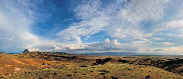 The area is characterized by tectonic-erosive and litho-structural ridges and crests, intrusive bodies (Dalidagh, etc), and intermontane troughs (Pirjan, Lachin, etc). Peneplanation planes within the watershed area and flanks (Mikhtocan), solid rock placers within Kalbajar ridge flanks, and gorgeous terraces can be observed within Lachin region. Karst relief forms are also evolved here. The sub-region includes Kalbajar, Mikhtocan, and Hakari geomorphologic districts.
Internal Minor Caucasus embraces areas that underwent Pliocene and Anthropogenic volcanic activity, as well as mountain and intermontane areas in which relief was developed under arid climate conditions. Volcanic type and Anthropogenic glacier-driven relief forms are widespread here. Currently, such key relief-formation processes as arid-denudation ones are underway. This region is divided into Garabagh volcanic plateau, mountain area adjacent to Araz River, and Nakhchivan (Middle Araz) depression geomorphology sub-regions.
1. Most of the Garabagh volcanic plateau sub-region consists of Upper Pliocene-Anthropogenic lava sheets, lava flows, and volcanic cones. Its central part at 3000-3500 m level has a rolling surface. The major eruption centers such as Boyuk Ishigly, Gizilboghaz, and Kechaldagh give evidence of the ancient and recent nival-volcanic relief forms. Intact and flat lava flows cover staggered relief surfaces. Final effusive lava sheets crept down the slope like 25-30 km long flow tongues from their eruption center towards Tartar, Hakari, Bazarchay, and Arpachay Rivers. Erosion processes impact upon lava sheets split around Girmizidagh, Ayichingily and Parichingily promoted pebble deposit formation. The riverbeds have cut deep gorges at the plateau margins. The River Network is poorly developed within the plateau area. Drailess areas contain the lakes. Sub-region includes Gizilboghaz- Ishigly, Alagollar- Kalbajar, Boyuk Goycha, and Yazi geomorphologic districts;
2. Mountain zone adjacent to Araz River sub-region embraces such ridges as Daralayaz, Zangazur, and Bargushad. Ancient volcanism-driven relief forms are dominant here. The high mountain zone is characterized by rocky and dissected relief and widespread explosive volcanic materials. There are also such relief patterns as ancient glacial forms (corries, flat-bottomed valleys). Erosion incision depth exceeds 1200 m. Below 2400 m level there evolved peneplanation planes. Here, there are depressions surrounded by mountains (Badamly, Tirshak, Aylis, etc). Monocline ridges and crests along with synclinal plateaus dominate within the close vicinity to Araz River valley. Flanks of just mentioned structures are attributed to badland and pseudokarst features. Sub-region includes Daralayaz, Zangazur, and Bargushad geomorphology regions.
3. Nakhchivan (Middle Araz) lowland sub-region basically embraces plain vicinity around Araz River. The dominant process here is accumulation one. Intrusive bodies jutted out along the border-line between the plain and the mountain area (Nahajir, Alinja, Alandagh), in some places like stand-alone elevations. In the close vicinity along the Araz River, there are monocline crests (Nakhchivan AR, Daridagh) and synclinal plateaus. Flanks of said structures are typified by badland and pseudokarst relief forms. The following geomorphology sub-regions as Sharur, Nehram, and Ordubad have been delineated here.
Talish geomorphology region consists of Talish mountains (Talish, Pestashar, and Boruvar ridges) and Lankaran lowland. One of the typical relief features is ridges and wide intermontane troughs (Yardimly, Zuvard, etc). Due to landscape inversion, predominantly Talish high-mountain zone is attributed by arid-denudation processes and relevant relief forms were generated by arid-semi-desert and dry steppe conditions. The Mountain zone has undergone severe dissection caused by the dense transversal relative to the ridge extension drainage network. Marine terraces have evolved within the river valley watercourses trending towards the Lankaran lowland. Peneplanation planes can also be observed here. Watershed ridges are relatively smoothed, while River valley flanks are gentle. Landslides are observed on the northern flanks. West of the region is rimmed by a narrow margin of inclined foothill alluvial-pluvial, and partially marine plain (Lankaran lowland). The following geomorphology districts have been delineated in the region: Lankaran, Burovar, Yardimly, Peshtasar, Zuvard, and particularly Talish (ridge).