


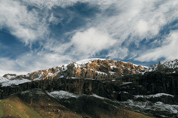
The main contemporaneous relief components and key geomorphologic features have been generated during the recent stage tectonic activity (Pligocene-Anthropogenic) and underwent a tricky evolution history. During this stage of evolution, the mountainous areas have risen up to 2.5-4.5km high (given that denudation has not been taken into account), whereas plain areas have subsided in the range from 2.5-3.0 to 8-11,5km. In areas where ascending movement rate exceeded that of denudation, mountain terranes have emerged, whereas within subsided areas (given that subsidence rate is equal to that of marine and terrestrial sedimentation), plain terranes have been generated. Though structural architecture and geologic evolution in these region's history are different, their relief formation processes had something in common. One of them is the fact that the Caspian Sea level served as a common base of erosion. Caspian Sea level fluctuation had a tremendous and recurrent impact upon both mountain and plain terranes' relief evolution through erosion processes activation, attenuation, and keeping pace with subsidence, and in this context, relief peneplanation processes had been in common. However, some discrete areas had their own specific relief formation features (magmatic processes within the Minor Caucasus, mud volcanism activity within the Great Caucasus southeast termination). The evolvement of relief-forming exogenic processes also differs dependent on rock composition, climate, and type of elevation zone features.
During the evolution of neotectonic relief formations within the Republic of Azerbaijan, such processes as changes in tectonic regime, and elevation rate increment played a significant role that resulted in a widening of such systems as the Great Caucasus, Minor Caucasus, and Talysh 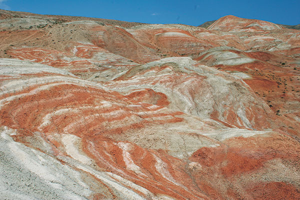 Mountains. Since the onset of this evolution stage intermontane depressions had accumulated fine sand and clay sediments, and coarse-grained sandstone and pebble deposits during the stage termination. Tectonic movement contrast increased during Oligocene-Early Miocene time. River system base level had been established just that time. Peneplanation planes came out during tectonic activity quiescent periods. During the Middle and Late Miocene time relief terrane formation remains the same as during the Early Miocene time, however, its development was underway in more sustainable tectonic circumstances. During that period of time vast peneplanation planes had evolved.
During the Late Miocene termination tectonic elevation rate abruptly had increased within the Great and Minor Caucasus intermontane systems. Relief contrast increased and mountain elevation increased too. Relief erosion and washout material transportation increased that led to drainage area base-level change. During the Early and Middle Pliocene time mountain elevation process also increased along with continued tectonic motion differentiation increment. It is supposed that vertical landscape zoning was first established at that time. In this context, exogenic processes had occurred in a somewhat different mode. The recent relief of the territory of Azerbaijan had been formed during the Late Pliocene-Anthropogenic time. In this connection, that period of time was characterized by relief development and Caspian Sea level fluctuation that led to marine transgression and regression development, as well as volcanism activity. In parallel with each regression, the development sea receded to increase terrestrial areas while the riverbeds extended to achieve stepping back shoreline. Erosion base level drop led to the river- beds got deeper, and erosion processes activation within their drainage area and drainage network itself underwent significant spatial changes. Marine terraces had been developed due to Caspian Sea level recurring fluctuation, whereas magmatic (Minor Caucasus) and mud volcanism (Great Caucasus) relief was developed due to both kinds of volcanic activity.