


NORTH-WEST ROUTE: BAKU — GOBUSTAN — SHAMAKHI — ISMAYILLI — GABALA — OGUZ — SHEKI — GAKH — ZAGATALA-BALAKAN
Gobustan district is one of the administrative districts of the historical province of our country called Shirvan. In the 8th-16th centuries in the territory of Shirvan, there was one of the most important state institutions of Azerbaijan — the state of Shirvanshahs, located in the capital city of Shamakhi. It was this state that existed for the longest time in the history of the Middle Ages.
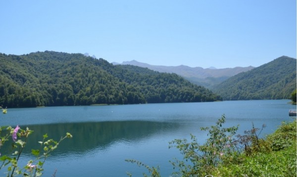
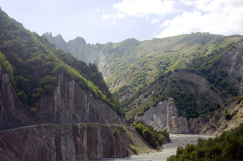
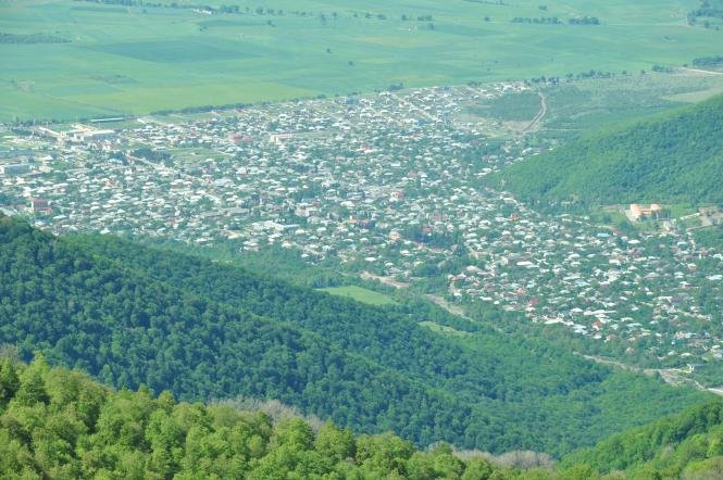
Present Gobustan district is located to the east of Shamakhi, 101 km away from Baku. Here the relief of the territory — gorges, ravines, rocks, toponymical reflected. The spring of these places is very beautiful, with tulips, chamomile, and irises.
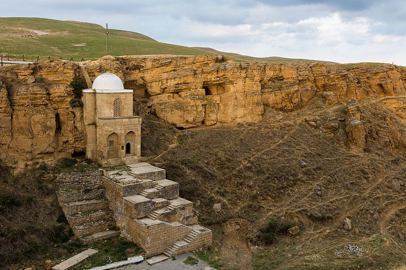
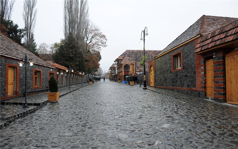
The climate of the region is mainly semi-desert. The most interesting and attractive object here for tourists is cave labyrinths (spheres), located in the village of SOYUNLU, in the gorge near the city. Here it is possible to observe a very original natural phenomenon, which is popularly called "Weeping Rock". According to legend, the "tears" flowing from this rock are the tears of the mother who killed the soldier sons. Caves are a system of natural galleries adapted for living, artificially expanded, and adapted during Tribal Wars and raids by foreign invaders in Azerbaijan in the Middle Ages.
The administrative center of the Gobustan district, the city of Gobustan, is located on the Maraza plateau, near the main highway of the district. According to one legend, the name of this city ("Maraz") was named after this event because the beloved wife of one of the influential people settled here and recovered. No one knows if this narration is true, but near the Maraza there is a spring of MINERAL water. Although its juice is brackish and bitter, it heals certain gastrointestinal diseases.
The famous kurgans of Shikh DUZU, the remains of ancient human settlements dating back to 1-8th centuries BC, located on the ancient trade routes of the village of DAG KOLANI, DIRI BABA tomb around the city (15th century); the remains of Shah ABBAS Caravanserai located in the very center of the city show that these places were human settlements in ancient times.
They were into carpet weaving here from ancient times. Patterns of local "Maraza", "CHUKHANLI", "CHAMJEMLI" carpets are popular all over the world. "NABUR" carpets are still woven by hand in the village of the same name.
You can stay here at the hotel "Gobuland".
SHAMAKHI
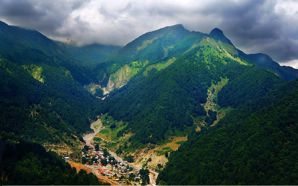
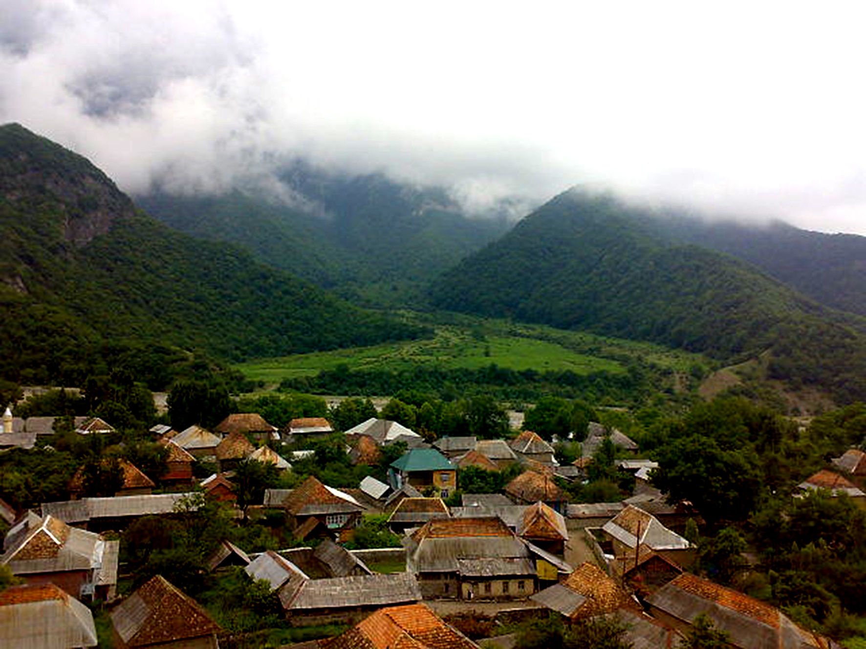
Shamakhi region-historical region of Azerbaijan, the center of ancient Shirvan, where the former state of Shirvanshahs is located. It is located on the south-eastern slopes of the Greater Caucasus. The climate of the main part of the region is mildly hot and dry in summer. The landscape is changeable. Here the steppes are replaced by foothills with grass, then forests. The cooler the fall rises above the sea level, the more snow remains in winter. But in general, the climate of the region is mild, the lands are fertile, rich in flora and fauna. Roe deer, wild boars, wild cats, foxes, wolves, bears, and many species of birds live here. Broad-leaved forests such as hornbeam, birch, oak, blue meadows covered with scarlet tulips are pleasing to the eye. More than 50 species of medicinal plants grow in the territory of the region.
Shamakhi district is the largest viticulture center of Azerbaijan. Shamakhi wines were popular not only in the local market but have long been awarded medals and diplomas at international exhibitions.
This region is a popular place of rest for the residents and lovers of sports tourism in the capital of Azerbaijan. Those who like to travel on foot, go on an excursion here to Guba and ISMAYILLI. Ecological tourists and ordinary travelers try to go to the forest of Jangi. Wild apple, pear, and cherry trees grow here, along the edge of the forest and near the gorge, springs of sulfurous water emerge from the ground. Famous "SHIRVAN", "SHAMAKHI", "ISRAFIL" and "ERJIMAN" carpets are woven in mountainous villages.
There are a lot of interesting places in the Shamakhi district. Molokans from Russia live in CHUKHURYURD settlement located on the Right Bank of PIRSAATCHAY River. Their delicious sunflower oil, pickled vegetables, mountain honey, vegetables, and fruits produced for sale in the capital of the Republic are very popular. There are many drinking water springs in the area called GIRKHBULAG. Near the village of Salam there is a famous cave named for its healing properties. Very famous in the East poet AFZALADDIN KHAGANI was born in this village in the XII century. In general, this region became famous for its poets, philosophers, and architects. SEYID Azim Shirvani, Imadeddin Nasimi, Mirza ALAKBAR SABIR, Haji ZEYNALABDIN Shirvani, Mahammad Shirvani, Azim AZIMZADE, ABBAS SAHHAT, Hamadi Shirvani, Falaki Shirvani are the children of this land (frequent repetition of the word "Shirvan" in their names is connected with a tradition that existed in the East since ancient times. As a rule, the name of the surname, which he adopted after becoming a famous person, is reflected in the name of his place of birth).
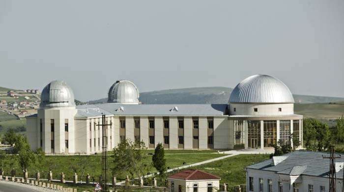
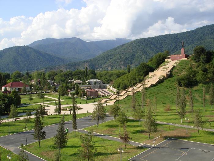
Shamakhyastrophysical Observatory named after Nasreddin Tusi (SAO) located near PIRGULU settlement is 1400 meters above the sea surface. One of the largest telescopes in the former USSR was installed here. One of the first Presidents of the Azerbaijan National Academy of Sciences, academician Yusif Mammadaliyev, who laid the foundation of petrochemistry in Azerbaijan, once did a lot to organize this Observatory. A statue of Y.Mammadaliyev has been erected here at the initiative of scientists working now in the territory of Shao as a sign of gratitude. Baku schoolchildren are always looking forward to going on an excursion to the Tusi balloon and seeing a huge telescope there. Residents of Baku, who do not usually snow in winter, are more eager to come here: because the snow in Pirgulu stays on the ground for a long time, so when you come here you can play snowballs. In summer, local residents, at the request of guests, take them for a ride on horseback.
Historical monuments of the region: Juma Mosque (VIII-X centuries); pirmardakan Tomb (XIII-XIV centuries); shahkhandan Tomb (XVII century); seven GUMBEZ complex consisting of 7 tombs (XVIII century); remains of legendary GALAYI-BUGURT fortress (XII-XVI centuries); this castle located near the mountain village of the same name as Sal kaya. In GULUSTAN fortress (VIII-XV centuries) Shirvanshah Shahrukh bravely repulsed the attack of Iranian troops. Shirvanshah's Palace and unique water supply system remained intact in the fortress. Historical monuments of the region: Juma Mosque (VIII-X centuries); pirmardakan Tomb (XIII-XIV centuries); shahkhandan Tomb (XVII century); seven GUMBEZ complex consisting of 7 tombs (XVIII century); remains of legendary GALAYI-BUGURT fortress (XII-XVI centuries); This castle, located near the mountain village of the same name, seems to be attached to the rock. In GULUSTAN fortress (VIII-XV centuries) Shirvanshah Shahrukh bravely repulsed the attack of Iranian troops. Shirvanshah's Palace and unique water supply system remained intact in the fortress. The hidden water pipeline provided the defense fortifications with water. Stone fences and slaves intended for storing water remained intact. Pirgulu Reserve was established in 1968. The total area of the Reserve is 1521 hectares and consists of three parts, 1362 hectares are forests located at an altitude of 800-2000 meters above sea level. The flora of the reserve includes 45 species of rare and endemic plants, the name of many of them is included in the Red Book.
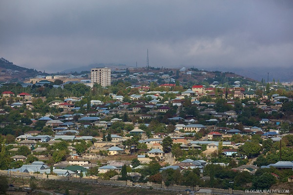
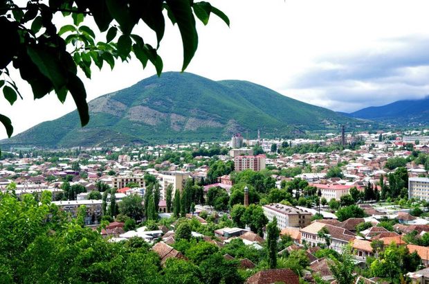
The administrative center of the district is Shamakhi city. The distance from Baku is 120 km.
In ancient times, present Shamakhi city called "Sharvan", "Ashshamakh", "Shirvan", "Shakh-Makh" was the capital of Shirvan-Shirvanshahs state. One of several small states formed in the VIII century after the weakening of the Abbasids dynasty was Shirvanshahs state. This city has a glorious but tragic fate-it has been destroyed many times. These destructions were connected not only with the raids of the invaders but also with earthquakes because this place is a high seismic area. In 1191, when Gizil Arslan from the Atabey ELDAGEZ dynasty seized this city and devastated it, Shirvanshah I Akhsitan temporarily moved its capital to Baku. In 1501, Shah Ismail Safavi occupied both Shamakhi and Baku. After 37 years, the existence of the state of Shirvanshahs was terminated and Tahmasib Safavi created the state of the Safavids. In later periods Shamakhi was repeatedly destroyed in wars between the Safavids and Ottoman Turks. At such times, along with the death of people, architectural monuments and books were also destroyed...
However, the people of Shamakhy have always found strength in themselves and restored the city and arranged their livelihoods. Alexander Duma, who had traveled to Azerbaijan in due time, wrote about Shamakhi that residents of this city never know whether they will survive tomorrow. At present, many ancient monuments are preserved around Shamakhi.
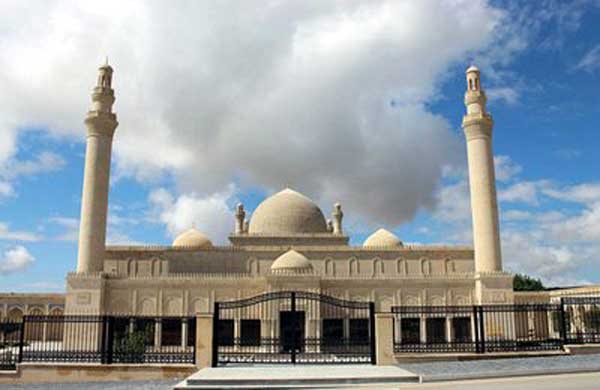
Shamakhi is located in the Juma Mosque, the oldest mosque not only in Azerbaijan but also in the entire South Caucasus. It was built 743 years. In 2013, a major reconstruction of the Juma Mosque was carried out. In addition, old cells were restored around the mosque. During the archaeological excavations, madrasas, cells, and tombstones found in the courtyard of the mosque were found.
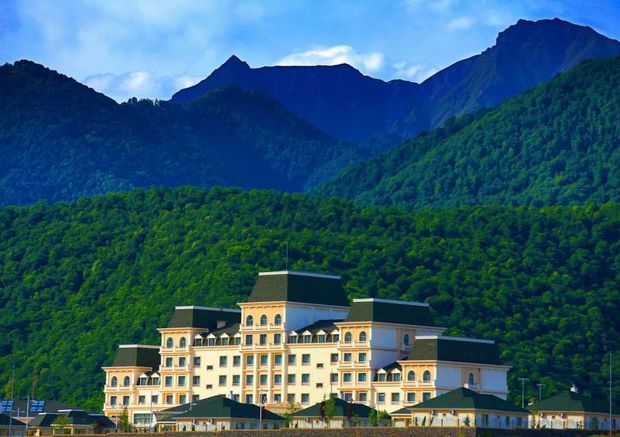
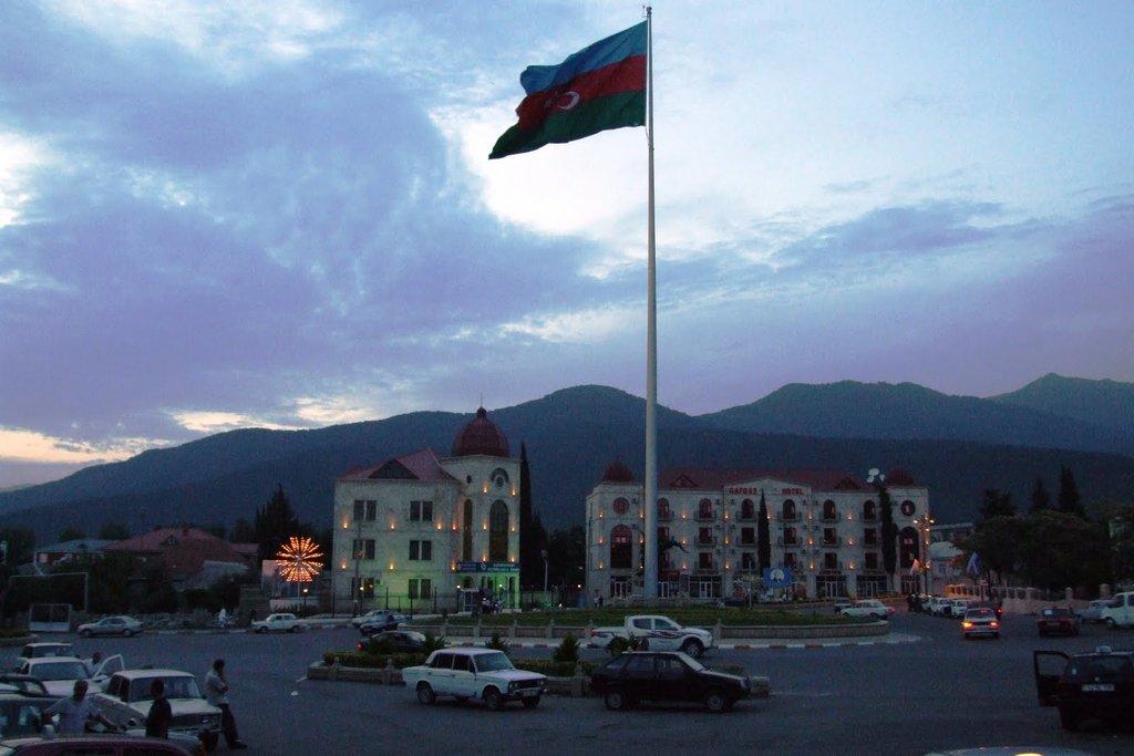
In Shamakhi, you can stop at such beautiful hotels as "Shirvan Hotel & SPA", "Sakit Lake — Silent Lake Hotel", "Samaxi Palace Platinum”.
ISMAILLI
Three of the 8 climatic zones existing in Azerbaijan are found in the territory of ISMAYILLI region. The winter here is dry, mild, the weather in the plains is hot, precipitation is regular, and in the mountains winter is cold and humid. The main relief of the region consists of mountains. This place has a very beautiful nature. Forested mountains, rocks, rivers (GIRDMAN, AKH-OKH, GOYCHAY), waterfalls (GALAJIG — height 50 meters, CHAYGOVUSHAN — height 30 meters, ISTISU — height 25 meters, madrasa — height 25 meters). On the slopes of BABADAGH at an altitude of 3500 meters above sea level, 3 natural lakes, three artificial lakes near the villages of KURDMASHI and ASHIGBAYRAMLI are very picturesque and suitable places for fishing.
The "ISMAYILLI" Reserve was established in 1981. With an area of 5,778 hectares, this reserve consists of two parts — artillery and will remain. Their distance from each other is 1 km. The forests of the Reserve occupy 5021 hectares, subalpine meadows 227 hectares. Here you can meet more than 40 species of wood and shrubs, 170 species of vertebrate animals — deer, mountain goats, wild boars, bears, wolves, foxes, hares, etc.
The name of this district fell on the history of Russian literature: M.Y. Lermontov wrote his poem "Ashig Garib" on the basis of the saga heard about Ashig Garib from Oruj (people's singer) and Ashig Lezgin Ahmad while he was in Tirjan village of Ismayilli.
The name of this district fell on the history of Russian literature: M.Y. Lermontov wrote his poem "Ashig Garib" on the basis of the saga heard about Ashig Garib from Oruj (folk singer) and Ashig Lezgin Ahmad while he was in Tirjan village of Ismayilli.
Since ancient times, along with Azerbaijanis, representatives of other peoples and ethnic groups — lezgins, Jews, Russians (molokans living in Ivanovka village), lahijs (Iranian-speaking tribe), hapits (heirs of ancient Albanians) have settled in this area.
The traditions of ancient art and applied art have been preserved in Ismayilli region. Carpet weaving (GALAJIG and TAZAKAND villages), utensils and weapons with forged patterns made of copper, tannery, blacksmithing, wood and metal carving (these professions are more common in Lahij village, many shops and workshops in the central street of this village), national head coverings called "KELAGHAYI" are made for women in BASQAL village. Patterns of kelaghayi made of silk fabric are engraved by pressing method.
It should be noted that Azerbaijani kelagayi was included in the UNESCO Intangible Cultural Heritage List under the name “traditional art of making and dressing kelagayi women's headscarf and its symbolism”. Copper production in Lahij is also included in UNESCO's list of intangible cultural heritage from Azerbaijan.
Historical and cultural reserves have been created in Lahij and BASGAL villages. Most of the monuments here are protected by the state. Badoy ZEVERO mosque (1791), Agali mosque, ZEVERO spring, mosque and bathhouse (XVIII century).
Other monuments: Maiden Tower in KHANAGAH village (XVII century), FITDAGH Tower in SULUT village (XVIII century), and a number of other archaeological objects. It is interesting that local residents associate the Fitdagh Tower with a narration about Alexander the Macedonian. It is said that Alexander of Macedon himself camped here, and his supporters climbed to the top of the mountain and informed each other about it with Golden Sheeps. Therefore, this tower is called Fitdag Tower.
Javanshir (VII century), one of the rulers of Caucasian Albania, according to legend, lived in a fortress near TALISTAN village on the top of another mountain on the Left Bank of GIRDIMAN River. GIRKHOTAG Tower, HARAM Tower, Khiraki defense wall, and Juma Mosque were also preserved in Sulut village.
The administrative center of Ismayilli district is ISMAYILLI city. The distance from Baku is 185 km. Ismayilli is also one of the winemaking centers of Azerbaijan, and all opportunities are created here for one direction of tourism-wine. Since the deserts of Ismayilli are unusually rich, hunting tourism is also developing in the region.
There are many hotels and recreation centers in Ismayilli. GAYA RESORT CENTER, MAIDEN TOWER, GREEN HOUSE, JULYAN RESORT CENTER, KALAMARJ, HASANOGULLAR RESORT CENTER, MAXUL, RIZVAN RESORT CENTER, KORKUT MONTOLIT.
GABALA
Gabala region is located in the north-western part of Azerbaijan, in the territory of Sheki-Zagatala zone, on the border of Dagestan and Georgia. This region has a very ancient history. People lived here even in the Neolithic period. Gabala was the center of Caucasian Albania for some time, and later it was part of Shirvanshahs state and Sheki Khanate. DEMIRAPARAN River, VanDam River, BUM River, TIKANLY River, and other rivers flow through the region.
Gabala region is named for its nuts and Chestnut Gardens. On the mountain slopes, at an altitude of 1000 m above sea level, there is a famous chestnut forest. The flowering of chestnut trees in spring creates a wonderful landscape. The trees in this forest are very old. The average age of each of them is more than 500 years. Some of these trees are included in the list of natural monuments protected by the state. Here you can hunt gazelle, roe deer, bears, wolves, hares, and other animals representing local fauna. One of the mountain routes going to the highest peak of the Republic to BAZARDUZU mountain (4466 m above sea level) passes through this region.
There are many historical, cultural, and architectural monuments in the region. Mosque in Bum village (XIX C), Albanian temple in Emili village (IV C), ustajan Tower in BAYRAMKOKHA village (IX C), Haji Garib mosque and CHOTARI Albanian Church in NIC village, Sheikh BADRADDIN and Sheikh Mansur tombs in Hazra village (XV C), the mausoleum in SHAFILI village (XVII C), as well as SHIKHBABA piri in HAMZELLI village (XVI C) and KOMRAD piri on the top of KOMRAD mountain (the place of burial of people considered holy and righteous in their health is called pir).
In YALOVLU mountain near NIJ village, archaeologists discovered the remains of ancient human settlements. Samples of archaeological culture found here are typical for northern regions of Azerbaijan and are known as "Yalovlu Hill culture" in science. Weapons made of iron and bronze, gold objects, millstones, and other samples were found here. Wood processing (VanDam Village), Pottery (GAMARVAN village), carpet weaving (LAZA and BUM villages) are widely developed. Zop-Zopa Folklore Ensemble established in Bum village has performed successfully in various festivals held in foreign countries. The udins live compactly in the village of NIJ in the Gabala region. This ethnic group, considered the predecessors of the ancient Albanians, managed to preserve the traditions, language, material and spiritual culture of their ancestors to this day.
The administrative center of the district, the city of Gabala, is located in the foothills of Shahdag. The ancient city of KABALA, named in Greek and Roman written sources (Pliny), was founded about 2000 years ago and for more than 600 years was the capital of Caucasian Albania. Ruins of the ancient city of Gabala are located near the modern Gabala (15 km from it) in the area between the GARACHAY and COVURLUCAY rivers. There are monuments such as the Tomb of IMAM BABA (XVIII century) and the Juma Mosque in Gabala. There is also a large museum of history and local lore in the city. In this museum, numerous archaeological finds discovered in the region have been collected.
Here tourists will be able to find everything you need for a good rest. Mountain air, beautiful rivers, waterfalls, and lakes delight the eye. A unique tourist route" Alexander Dumas in the Caucasus " is located on the territory of the Gabala region. This route is the same age as the writer's arrival in the Caucasus in 1858.
Not far from Gabala, there is a unique architectural monument — the Udi temple in NIJ village. Udi is considered to be descendants of the ancient Albanians, and there are about 10 000 representatives of this particular ethnic group. They have managed to preserve their language and cultural traditions to this day. In recent years, this temple has been restored and is now open to tourists. This recreation area is a popular tourist center, which is open not only to residents of Azerbaijan but also to tourists from different countries. Every year music festivals of mugham, jazz, classical music, and piano are held here. In addition, a large entertainment center “Gabala” was built in Gabala. This is the largest amusement park in Azerbaijan, located on 16 hectares. Here there is an ice rink, Sports Grounds, go-karting, XD theater.
Culture and tourism in the region are currently developing rapidly. There are very interesting hotels: "Caucasian Sport Gabala", "Caucasian Resort Hotel", "Caucasian Riverside Resort Hotel", "Caucasian Seven Beauties Resorts", "Caucasian Thermal and Spa Resort hotel", "Caucasian Karvansarai Hotel”.
On the outskirts of Gabala city is a recreation area "AI ISHYGY". High tourist service "mountain hostel", forest, excursions, hunting and fishing recreation is organized.
Located at 5 km of Baku-Gabala Road (area 1.5 ha), the "Sahil Lake Nokhur" recreation area is located. Tourists can go to waterfalls, forests, historical monuments.
OGUZ
Oguz district is located in the Sheki-Zagatala zone of our country on the southern slopes of the Greater Caucasus. This region, which borders on Russia in the North, is so beautiful that it is rightly called "Azerbaijan's Switzerland". A little less than half of the territory of the region is covered with forests. There are many waterfalls, sulfurous and thermal water springs here. Fauna of the region is represented by rabbit, Bear, Mountain Goat, wild boar, pheasant, partridge, goose, as well as som and forel fish. Various fruits and berries — walnuts, hazelnuts, apples, pears, cornel, hawthorn, cherry, cherry, cherry, currant, and raspberry grow in the region.
Traditional folk art carpet weaving (Filfilli village), metal and wood carving (BASH, DASH, AGHIL village) are continued. People here still led a sedentary lifestyle in the Neolithic period. At the beginning of our era, this territory was part of Caucasian Albania and in the XVIII century, it was part of Sheki Khanate. Archaeologists have discovered ancient human settlements near the villages of KARIMLI and KARABALDIR. Spears, bronze arms, women's sculptures made of stone, and staves were found here.
There are many ancient historical and architectural monuments in the region. DASHUZ Bridge on the SARISU River near KHACHMAZ village (XIX century), a mosque in SINJAN village (XVIII century), the mausoleum in KARIMLI village (XV century), three-storied tower in MUKHAS village (XIV century), defensive GABUR Tower in KHACHMAZ village (VII-XIV centuries) still located near GALADAGH peak but supplied with drinking water GAVURGALA Tower (VII century), SURKHAYKHAN Tower (XVIII century), built of river stone, located near FILFILLI River, on the Bank of GALACHAY River and etc.
The administrative center of the district is Oguz city. Ancient synagogue Jewish settlement (1849) in the area of Oguz city, Albanian temple where the Museum of local lore is located, one of the oldest schools in the territory of Azerbaijan, built in XIX century (such schools are also found in PADAR and KHACHMAZ villages).
Oguz itself is a small but clean city. Only 15-20 km around it are very convenient places for hunting and fishing. Although the tourist potential of this area has not yet been fully utilized, there are a number of recreational areas of the city and abroad, such as the guest Greenland, LT Hotel, and Afra Hotel. The main attraction of this region is the Khal waterfall, as well as the "Golden Fish” Family Recreation Center, where entrepreneurs have created several artificial mountain lakes. The peculiarity of this recreation area is that it provides guests with the opportunity to fish.
SHEKI
Sheki region is located on the southern slopes of the Greater Caucasus Mountains. The ruins of many monuments of early medieval architecture — castles, observation towers, churches, temples of Caucasian Albania have been preserved in the settlement of Sheki. More interesting are the monuments in the villages of BIDEYIZ, BASH KUNJUT, ORTA ZEYZIT, the church erected by Saint Elysee in the village of Kish. This church is considered to be the oldest Christian building in the territory of the Commonwealth of independent states. At present, the church has been restored and turned into a museum.
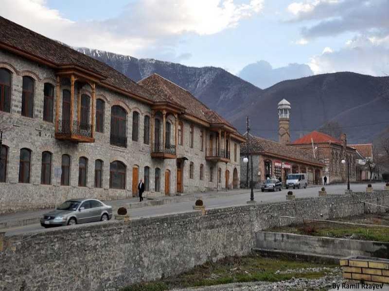
Sheki city is the main city of Sheki-Zagatala region. Sheki, one of the oldest and most beautiful cities of Azerbaijan, is supposed to be built in the first millennium BC. This city is mentioned in Arabic, Turkish, Georgian, Russian, and European written sources.
Scientists believe that the name of this city was derived from the name of the SAK tribes who once lived here. Sheki is located on the route of the Great Silk Road. Ptolemy wrote his name in the records about Sheki as Niga. The city is associated with enthusiastic people from around the world who have enjoyable. Old residents still call Shaki Nukha. In 1772, when the flood flooded Shaki, residents moved to the nearby village of Nukha. During the widespread Christianity, Sheki was one of the religious centers of Caucasian Albania. During the period of Arab-Caspian Wars (VII-XIX centuries) this city turned into an area of military conflicts and clashes. When the Arab Caliphate zayiflak, the principality created here was part of the Shirvanshahs ' state.
During the reign of the Elkhanids dynasty, the stage of progress began in Sheki, and the city became the center of an independent territory under the rule of the local ruler Sidi Ali (Seyid Ali). During Tamerlane's attacks, Sidi Ali resisted the invaders and then took the troops led by him and went to help Nakhchivan, who heroically defended ALINJA Castle at that time (1397-1398 years).
 At the famous Sheki markets, there was a fierce exchange, where grain, dishes embroidered with tattoos, and jewelry made by jewelers were sold. There are different types of Sheki silk — soft and non-shafikav, thin and shafikav, dark-colored or with gulabatin thread... craftsmen of this city have made a great contribution to the development of trade along the Great Silk Road. Sheki was the center of Sericulture of the whole Caucasus. In 1862, 62,239 Poods of Silk were produced in Nukha (Sheki) province. In 1861, the first silk-spinning factory was built here. It was one of the largest factories in the world. In 1862, at the International Exhibition in London, Sheki silk was awarded a gold medal.
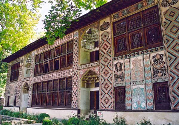
Sheki is proud of the famous philosopher, writer, and enlightener Mirza Fatali Akhundov. In this city, there are house-museums of M.F. Akhundov and SABIT RAHMAN. Sheki Khan'S Palace is a unique example of the connection of folk architecture (carving on wood and clay) with the traditions of the palace architecture of the east (wall paintings painted with varnish).
The dimensions of the lower caravanserai and the upper caravanserai built in the XVIII century show that trade was widely developed here in the Middle Ages.
The ruins of the ancient fortress "GELERSEN-GORERSEN" are preserved near Sheki, on the West Bank of the river Kish. From the name of this fortress, it is known that its defenders were determined not to let the enemy into this fortress and were sure of the invincibility of the fortress. The events that happened to the heroes of Lev Tolstoy's narrative "Hadji Murad" take place in this fortress. Alexander Dumas, Kempfer and N.Rayevsky was in Sheki. N.Rayevsky wrote in his letter: "our camp is in a forest with trees like tamarisk, pomegranates, plane trees and others... Nukha is a wonderful place." In 1805 Sheki Khanate became part of Russia and its existence as a Khanate was terminated. In 1819, by the decree of the Russian Tsar, the Nukha province was established and Sheki was managed by the Tsar's Commandant.
There are a lot of attractive cultural objects in this city: The Drama Theater named after Sabit Rahman, the Museum of decorative and Applied Art, The Art Gallery are such objects. The inhabitants of the nin have preserved their unique traditions and knowledge of ancient art even today. Silk caps called "KELAGHAYI" are exported even to Central Asian countries and used there by local craftsmen for the purpose of embroidery on silk. Wooden chests with special patterns of Sheki are also made here. And The Shape of ornaments made by local jewelers has changed little since ancient times. The art of needlework called TAKALDUZ was highly developed in Sheki. Previously, this work was mainly dealt with by men. In addition, hat-making, making musical instruments and networking are continuing in Sheki. Such frames made of patterned wooden net and decorated with colored shushets are usually used indoor and window places. Original Sheki cuisine, which has no analogs in Azerbaijan, is also included in the unique culture of Sheki. The unusual sweets (Sheki halva) cooked by the citizens of Sheki are obtained by spreading thin yukha from the dough, which is mixed with rice flour, and by shaping them.
Sheki is famous for its natural beauty. Here all the conditions for active sports and simple but pleasant walks are created, at which time you can generally watch the mountains, forests, and nature. Medical and massage centers, restaurants, cafes, and shops are also open for tourists.
There are modern hotel complexes in Sheki, such as "Sheki — Karvansaray" hotel. Sheki Palace Hotel, Issam Hotel & Spa, Sheki Palace Hotel.
Marxal Resort & SPA.
One of the perfect places of rest in Azerbaijan is the hotel "Marxal Resort & SPA". This beautiful Health Complex is located in the beautiful village of Markhal in Kish village, near Sheki, at an altitude of 1,080 meters above sea level. The hotel is surrounded on all sides by mountains, which means that here you can find clean mountain air and an unforgettable holiday. For fans of entertainment, there is an opportunity to ride a bike, you can dance in a nightclub or sing in a karaoke hall, there is a cinema hall, bowling alley, and a billiard room. Every evening, guests of the hotel are waiting for interesting entertainment shows. There is a unique Amber Room here — one of the few places in Azerbaijan and one of the few in the world. The room is assembled from untreated natural Ukrainian Amber, embodying solar energy. It's great to be in such a room. Since ancient times, amber heals almost all diseases.
GAKH
Located in the northwest of the Republic, the Gakh district shares a border with Georgia. The region has a dry climate in the South, mildly hot and subtropical humid climate in the center, cold in the mountains, and regular distribution of precipitation. As we can see, there are four climatic zones here in a relatively small area. The temperature range in Gakh is very high, with temperatures ranging from minus 40 degrees to positive 40 degrees near Lake AJINOHUR.
"ILISU" State Reserve is located on the territory of the district (the area is 9.2 thousand hectares). The main Protected Objects here are forests in the middle mountainous zone (90% of the Reserve's territory). It is possible to find about 300 species of plants, including 90 species of wood and shrubs, a number of endemic and endangered species. In the mountain, forests live bears, mountain goats, wolves, wild boars, wild cats, and jackals. There are suitable places for animals and fishing in GANIG-AYRICHAY Valley.
There are many historical monuments in the territory of the Gakh district. The burial mounds discovered by archaeologists here prove that this region was inhabited even in the Bronze Age. ULU KORPU, SUMUG GALASI was built in the XVIII century and the mosque located in its center was formerly the capital of Ilisu Sultanate. Sumuq remained in the memory of the people as one of the forces behind Daniyal Bey, The Last of the local sultans, the brother of Sheikh Shamil. In these places, people have been inhabited since very ancient times. Archaeologists have discovered here the jug graves of the I century before our era. In Ilisu, a Square watchtower with a height of 10 meters remained intact (XV century). There are many sulfur thermal springs around this village.
In the forest near TIRMACHI village, where old oak trees grow, there is the grave of Naib (commander of Sheikh Shamil) Hadji Murad. The following words were written in Arabic on the tombstone: "a great sufferer, avar Haji Murad Khunzakhski was buried here".
Monuments of Caucasian Albania period — SIRTGALA fortification (XVIII century), ruins of gum Basilica (V century), round temple (VII century), temple complex in LEKIT village (XII century) were preserved near Gum village.
In the villages of SARIBASH and JALAIR, local artisanal women sew original embroidered carpets and woolen socks. Local residents produce wine at home in Gakhbash village.
The administrative center of Gakh district — GAKH city is located at an altitude of 500 meters above sea level. The meaning of the name of this city, located on the banks of the mountain river GURMUKHCHAY, at the foothills of the Greater Caucasus, is "gala".
Here you will be able to stop at EL Resort, Eden Park Hotel, Senger Ghala, Ulu Dag Resort, and Green Park Resort, as well as at Ilisu and Shefa medical hostels and take hot therapeutic baths.
ZAGATALA
ZAGATALA district is located on the slopes of the Greater Caucasus, in the north-western region of our republic. The region is bordered by Russia on the northeast side. Relief of the region is mountainous and lowland, the climate is cold in mountains and hot in Plains. There are a lot of forests in the district, but they are mainly located in the mountains and in the foothills. Flora of Zagatala region is rich with different valuable tree species — chestnut, walnut, hazel, oak, hornbeam, elm and etc. Fauna is represented by deer, mountain goats, wild boars, bears, wolves, hares, as well as many species of birds — girgovul, partridge, mountain hawk, hawk, turaj, jackdaw, and nightingale.
In 1929, "ZAGATALA" State Reserve was established here on the southern slopes of the Greater Caucasus Mountains. With an area of 23.843 hectares, the Reserve is located at an altitude of 650-3646 meters above sea level and covers the territory of both Zagatala and Balakan districts. On the territory of the reserve there are suitable places for rest and overnight stay of tourists. Near the village of QAS, there is a lot of snow in winter.
Along with Azerbaijanis, representatives of ethnic groups of other nationalities — russians, avars, lezghins, tsakhuolar, tatars, ingiloys — about 20 people live here peacefully.
The historical monuments of the district are located in villages that have been preserved from the most ancient times to the present day. Mosques of the 18th century in the villages of GEZBARAH and Halal, two towers of the 14th century in the village of Kebeloba, a tower of the 12th century in the village of Mazykh, a Pari tower of the 5th century in the village of Upper Chardakhlar, a KINGAZ tower of the 14th century in the village of Ker and the district Museum of Local History, an Albanian tower in the village of PASHAN (13th century) and an Albanian tower in the village of Akhahdar (12th century), Aliabad and Mosul in preserved mosques built-in in the 19th century.
Tourists like to visit the village of JAR, which is located 6 km northwest of Zagatala city. In addition to being a beautiful corner of the local nature, the village has preserved its original architectural, construction, and living traditions inherent in this region.
ZAGATALA city, the administrative center of Zagatala region, is located on the Bank of the TALACHAY River at an altitude of 535 meters above sea level. The distance from Baku is 372 km.
This city deserves to be called a real resort due to its climatic characteristics and beautiful nature. There is a park of culture and recreation on an area of 15 hectares, an interesting natural monument — the 800-year-old plane tree is also located here.
The ancient castle in the city (1830) is interesting not only because of its antiquity but also because it imprisoned the sailors, who once rebelled in the armored grief "POTYOMKIN". A monument to S.Demashko was erected in the local park. The monument to Sevil Gaziyeva, the first woman in Azerbaijan who was driving a cotton-harvesting machine, is also interesting.
A rich collection of medieval manuscripts has been collected in the History-Ethnography Museum in Zagatala city.
Another interesting Zagatala monument is the Armatai fortress, which is associated with the legendary hero Prometheus. The city has an ancient fortress built-in 1830. There is a museum of history and local lore with a rich collection of medieval manuscripts in Zagatala. Lodging is available in "Zagatala Hotel", "Turgut hotel", "Salamander Cottage".
Located in the north-east of Azerbaijan, BALAKAN district shares borders with Georgia in the south and West, with Russia in the North and East.
The relief of the region is distinguished by contrast: mountains and plains replace each other here. In the plain regions mild-hot, dry in winter, in the foothills-mild-hot, with regular distribution of precipitation, in the mountains-cold humid winter (average annual humidity level is more than 40%).
There are many mountain rivers, a beautiful lake near Mountain Katekh, and in the north of the district, the area is covered with forests. More than half of the territory of Zagatala Reserve is located in the Balakan district. In 1929, "ZAGATALA" State Reserve was established here on the southern slopes of the Greater Caucasus Mountains. Now, with an area of 23,843 hectares, this reserve is located at an altitude of 650-3646 meters above sea level. According to the nature of its vegetation, this reserve can be divided into mountain-forested (67.4%) and mountain-meadow parts. The flora of the reserve includes more than a thousand, including rare plant species (hornbeam, alder, oak, walnut, chestnut, acacia, more than 30 species of medicinal plants). The fauna of this region is also rich. It should be especially noted the widespread here of the black-colored Caucasian forest cock.
There are many historical and architectural monuments in the region. Archaeologists have discovered many ancient human settlements belonging to the early Iron Age. For example, 2 km from the village of MAHAMALLAR there are traces of early Iron Age human settlements in Nokho cave near the rock of navel. There, near the village of MAHAMALLAR, there were also graves of pitchers (II-I centuries BC), remains of a sanctuary and residential buildings (V-VIII centuries), a mosque (XVIII century), a tower (XIX century), fortress walls.
There are underground water reservoir of XVIII century and MASCHID in GULLAR village, mausoleum of XIV century in Tulu village, temple of XIV century in Hanifa village, temple of XVI century in XALATALA village, Albanian temples in Hanifa and MAZIMCHAY villages, fairy Tower of XII century in GULLAR village, GUMBEZ River Bank, city of Early Middle Ages in MAKHLAKAN mountain.
The administrative center of the Balakan district is BALAKAN city. The distance from Baku is 394 km. Mosque building belonging to XVII-XIX centuries, which caused interest due to the unusual height of its minarets is preserved in the city.
In the local museum of the region, traditional art items for this region, archaeological finds showing the Neolithic settlement of this region, and other exhibits allowing to follow the events related to the history of the region have been collected. The professions of coppersmithery, shebeke (making patterned wood frames for doors and windows), wood carving, and pottery are well developed in Balakan. TEKELDUZ embroidery, which is rarely found in Azerbaijan, has been preserved here (it is called The Art of sewing fantastic silk thread patterns on Tekelduz — dark background).
Balakan has a large city park with an area of 7.5 hectares. After a walk in the city, you can relax in this park.
The variety of flora and fauna of the Balakan region creates useful prospects for the development of Tourism. 12 tourist routes and recreation areas have been identified in the region. In the Balakan region, mainly sports and rural tourism are developing. Most tourists who visit the region prefer this type of Tourism. The city has a great culture and recreation Park with a cable car. Here you can stop at" Gubek Hotel", "Elite Saray Hotel".